Knoxville rolled into Tuesday under a blanket of fog and sticky, damp air, with showers and thunderstorms lined up to march through before 10 a.m. That timing puts the worst of the rain right on top of the morning commute, turning it into a soggy slog. Temperatures will climb into the mid-70s later in the day, but brisk southwest winds will make it feel a lot wilder than the numbers on the thermometer.
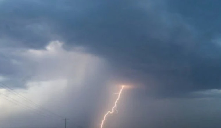
Morning Storms And Commute
Showers and thunderstorms are expected mainly before 10 a.m. Tuesday, with about a 70% chance of rain and brief heavy downpours capable of dropping a tenth to a quarter of an inch in short bursts. That kind of quick-hit rain can knock down visibility and leave standing water on low-lying streets right as traffic peaks, so giving yourself a little extra drive time is not a bad idea. According to the National Weather Service, the daytime rain should ease off in the afternoon before another batch of storms pushes in overnight.
Wind And Mountain Gusts
Southwest winds will ramp up to around 5 to 15 mph this afternoon, with gusts near 25 mph for much of the area. In the Smoky Mountains and foothills, downslope winds could crank those gusts up to around 50 mph overnight. A Wind Advisory is in effect for higher elevations and downslope-prone spots through 8 a.m. Tuesday, so count on blustery travel along exposed roads and ridge lines. Tie down or bring in loose outdoor items, and use extra caution on bridges and open stretches where the wind can hit hardest.
What To Expect This Week
Another round of showers and thunderstorms is likely Tuesday night into Wednesday, with the best chance for more organized storms coming late Tuesday evening into Wednesday and the potential for locally higher rainfall totals overnight. Temperatures are expected to moderate later in the week, with mostly sunny and cooler weather on Thursday and highs near 70. A final spell of mostly rainy weather is possible from Friday into Saturday. Forecasts may be tweaked over the next few days, so it is worth checking back for any changes to timing or severe-weather concerns.
Local Update
This story updates an earlier Hoodline post from Monday that flagged a two-wave storm setup for the region. New advisory details and updated gust wording from the National Weather Service prompted this fresh look at the forecast.
Preparedness Tips
Simple prep goes a long way: bring in lightweight patio furniture, park vehicles away from large trees when possible, and do not try to drive through standing or swiftly moving water. If the power cuts out, report the outage to your utility, and keep an eye on updates from the National Weather Service and local officials before heading out into the mess.


