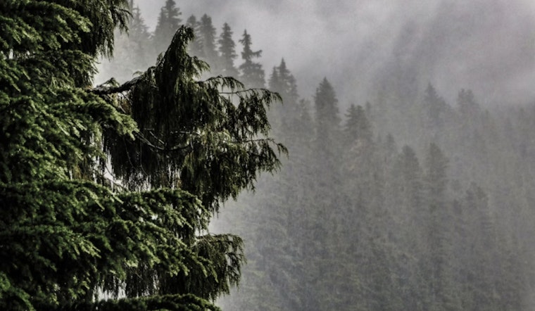
Sacramento is starting the week on a gray note, with light rain, patchy fog and chilly air hanging over the city early Monday morning, April 13. The airport (KSAC) is checking in at about 48°F with humidity close to maxed out. The damp vibe will not last all day, though. Skies are expected to open up later, with afternoon highs climbing into the mid-60s. The real drama is still in the mountains, where heavy snow and gusty winds are lined up through tonight, so anyone thinking about a high-country run should double-check conditions first.
Afternoon Into Tonight
By this afternoon, look for mostly sunny skies around Sacramento with a high near 65°F and light northwest breezes of about 2 to 6 mph across much of the valley. Monday night should stay mostly clear with lows near 46°F. A few isolated showers could linger over the foothills, but for most of the valley, the wet weather impact fades as the day wears on.
Mountain Snow And Travel
A Winter Storm Warning remains in effect for parts of the northern Sierra and western Plumas County through 11 p.m. Monday, with significant mountain snow and gusty winds still in the cards, according to NWS Sacramento. Forecasts call for about 6 to 12 inches of snow above 4,500 feet and as much as 18 inches along the highest peaks, with lighter amounts possible down to around 4,000 feet. In the heaviest showers, snowfall rates could top an inch per hour. Travel through mountain passes may be very difficult to impossible this evening, and road crews and emergency services continue to urge caution and solid preparation.
Commute Notes And Safety
Breezy southerly winds this afternoon could whip up valley gusts in the 20 to 30 mph range, with stronger gusts across the foothills. Isolated thunderstorms may spark brief heavy downpours or small hail. Drivers heading toward the Sierra should check chain control and road conditions on Caltrans QuickMap and carry chains or other traction devices, since the state often enforces controls during periods of heavy mountain snow. Around town, plan for some extra travel time, ease off the gas on wet pavement and avoid water-covered stretches of road.
Looking Ahead
After the early-week leftovers from the weekend storm, the forecast leans toward a gradual warmup and drying trend. Highs should land near 68°F on Tuesday, then bump into the upper 60s to low 70s by midweek, with sunshine gaining ground by Friday. A few light mountain showers could hang around Wednesday and Thursday, but the valley looks mostly dry. Anyone with outdoor plans or travel later in the week should keep an eye on updated forecasts, but for now, it is shaping up to be a much quieter stretch of spring weather.


