A weekend mountain bike ride above Tarzana turned into a full-scale rescue operation Sunday when a rider crashed on a steep ridge near Mockingbird Lookout and had to be located by helicopter using GPS from his phone.
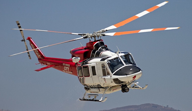
Los Angeles Fire Department crews launched a combined air and ground response to reach the 34-year-old man on the remote slope. Using GPS coordinates relayed from his phone, rescuers in a hovering helicopter lowered a firefighter to medically assess him at about 1:15 p.m., while ground units worked their way into the rugged terrain to set up a safe landing zone for transport.
According to LAFD, the incident was logged as INC#0882, with units from FS93, Battalion 17 and multiple Valley Bureau air and rescue teams responding. The department noted that dispatchers initially had only the rider's GPS coordinates to go on and reported that the airship was lowering a rescuer to medically evaluate and possibly assist the injured mountain biker.
GPS Limits and Hiker Safety
The National Park Service regularly warns outdoor visitors that GPS and cell service can be spotty or fail entirely in rugged areas. It recommends carrying a solid plan, extra water and a backup form of navigation, according to the National Park Service. The agency advises that if you do have reception, you should call 911, and it urges hikers to leave detailed trip plans with someone who can alert authorities if they do not return on time.
How LAFD Air Rescues Work
LAFD public alerts often describe a similar pattern in air rescues: a helicopter hovers over the scene, then lowers a flight paramedic to stabilize the patient before hoisting them aboard for in-flight care and transport. Those hoist operations are coordinated with ground crews, who work to guide the aircraft to nearby roads or designated helispots when steep or uneven terrain rules out a straightforward stretcher carry, according to LAFD alerts.
Where This Happened
The ridge and fire-road network north of Mulholland Drive above Tarzana, including access points near Marvin Braude Mulholland Gateway Park and Caballero Canyon, is a favorite with mountain bikers but is also known for being both remote and steep, according to the Mountains Recreation and Conservation Authority. Volunteers and rangers patrol parts of the system, yet agency and department alerts note that the difficult access often makes air extraction the quickest way out when riders get hurt.
There was no immediate information on the rider's condition. The LAFD post on X stated that crews were on scene and weighing extraction options. Officials and neighbors following the situation can track any updates through the original alert from LAFD.


