San Francisco woke up today under a cool marine layer with temperatures near 54°F at daybreak and mostly cloudy skies. That gray start should thin by mid to late morning, with most neighborhoods reaching the mid‑60s this afternoon. Southwest breezes will strengthen through the afternoon, so waterfronts and hilltops are in for a notably blustery day.
Foggy Mornings, Sunny Afternoons
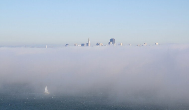
Readings show the marine layer is fairly deep this morning, around 2,000 feet, so low clouds are parked along the coast and have pushed into the North Bay valleys and parts of the Monterey Bay, which will slow the clearing through the day, according to the National Weather Service. Most locations should see the cloud deck erode by mid- to late morning, giving way to afternoon sunshine. Coastal spots such as Ocean Beach and the Embarcadero will hang onto the cool air the longest, so pack an extra layer if you are heading that way.
Afternoon Winds Pick Up
Southwest winds are forecast in the 6 to 13 mph range this afternoon with gusts up to about 18 mph through favored gaps and along the waterfront. That will make the air feel cooler than the thermometer suggests on exposed sidewalks and bridges. If you have outdoor plans, consider securing umbrellas and lightweight patio gear before the breeze turns them into airborne decor.
Boaters Should Take Caution
A Small Craft Advisory affects the northern outer waters through the morning, with choppy seas and hazardous conditions for small vessels. The advisory covers Pt. Arena to Pt. Reyes 10 to 60 nautical miles, per the National Weather Service. Ferry riders should expect a bumpier ride near the outer bay and heed operator advisories. Mariners and paddlecraft users should delay nonessential trips until seas ease.
Looking ahead, a trough is expected to swing through by Tuesday, May 26, 2026, bringing a gradual cooling trend and only a very slight chance of light showers along the coast.
Plan for a chilly start and a layered afternoon, with coastal neighborhoods staying coolest while pockets a few miles inland warm into the mid‑60s. If you are headed to the water, check operator advisories before you go and keep an eye on forecast updates throughout the day. We will post any changes if conditions shift.


