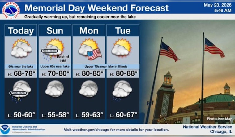
Chicago woke up to a gray start on Saturday, May 23, with cloudy skies and a cool chill in the air as temperatures hovered near 55°F across much of the city. Isolated showers have been hugging the lake and could still clip lakeshore neighborhoods through mid-morning, while most inland areas stay dry under the cloud cover.
Today And Tonight
Through the rest of the morning, isolated rain showers are expected to linger along the lakefront, but most inland spots should remain mostly cloudy with a high near 62°F and a light north-northeast breeze of 5 to 10 mph.
Late tonight, there is a slight chance of showers between about 1 a.m. and 4 a.m., followed by a broader chance of showers and isolated thunderstorms overnight into Sunday morning. The strongest thunder chances sit east of Interstate 55, with overnight lows near 54°F. A passing front is expected to move through Sunday afternoon and usher in drier conditions, with rainfall totals generally on the lighter side at only a few tenths of an inch where showers do develop. This forecast comes from NWS Chicago.
Memorial Day Outlook
Monday, May 25, is shaping up to look a lot more like the holiday weekend people ordered, with sunny skies and a high near 79°F along with south-southeast winds of 5 to 10 mph. Inland locations could edge into the low 80s by Tuesday, while lakeshore neighborhoods may stay a bit cooler under a lake breeze, so a light layer will be a smart move for early parades and ceremonies. Local event listings and parade details are available at Choose Chicago.


