Saturday, May 23, 2026 is starting out warm and sticky at Jacksonville Naval Air Station (KNIP), where the early observation showed 78°F with a dew point near 73°F and about 85% relative humidity. The rest of the day looks hot, with a high near 90°F and a 50% chance of showers and thunderstorms after 1 p.m., with the greatest coverage expected this afternoon when onshore sea breezes collide.
Afternoon Storms Could Pack A Punch
Scattered to numerous thunderstorms are expected to fire up this afternoon, especially inland near I-75 and US-301 where the Atlantic and Gulf sea breezes meet. These storms can bring brief but intense downpours and frequent lightning. A few stronger cells may produce damaging outflow winds and brief downbursts reaching 40–60 mph, and any slow movers could trigger localized street and yard flooding.
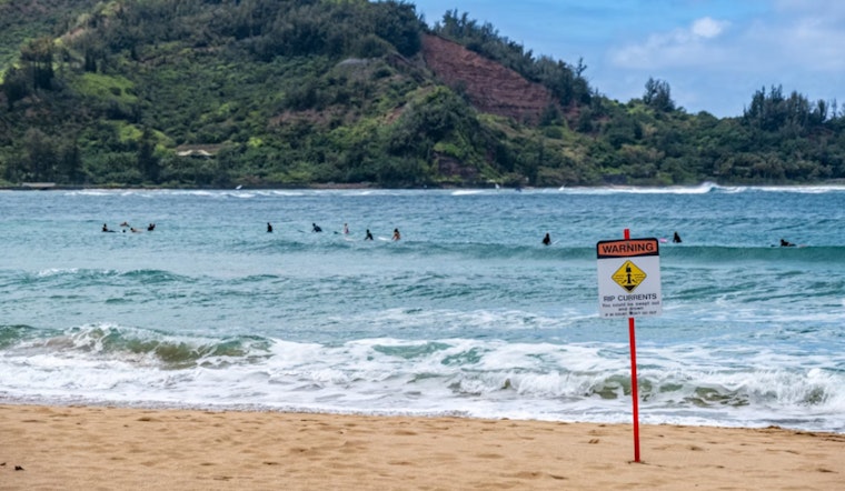
High Rip Current Risk For Beaches
A Rip Current Statement is in effect for northeast Florida beaches through late tonight, and swimmers are urged to stay close to lifeguards and avoid entering the surf while the High Risk is posted, according to the National Weather Service. Surf is running around 3–4.5 feet at many spots, and light onshore winds plus holiday crowds will combine to make conditions especially hazardous for swimmers.
Memorial Day Weekend Outlook
Sunday, May 24 is expected to stay hot, with a high near 88°F and roughly a 60% chance of afternoon storms, with many showers and storms most likely between noon and 5 p.m. Memorial Day Monday, May 25 looks warm with a high near 88°F and a lower 30–40% chance of showers and storms, although isolated stronger cells remain possible. For background on the recent coastal surf and safety trend, see rip currents put Jacksonville beachgoers on high alert.
Planning Tips
If you’re heading to the beach, pick a lifeguarded stretch, keep a close eye on changing skies and move activities indoors if thunder approaches. Bring plenty of water and shade, as heat index values could top the mid-90s, and give yourself extra time on coastal roads in case heavy rain cuts visibility.
Where To Get Updates
Keep tabs on local radar and advisories from the National Weather Service, and watch lifeguard flags at the shore, since closures and warnings can change quickly during active afternoon convection. If you’re unsure about surf conditions, contact Jacksonville Beach lifeguard services or check local media before you go.


