Jacksonville wakes up warm and sticky this morning, with clear skies, muggy air, and the nearby KNIP station already clocking about 76°F and southeast winds beginning to stir. By afternoon, temperatures should climb toward 87°F with just a small chance of brief late-day showers or an isolated inland storm. If you are thinking beach, keep the towels handy but the expectations flexible: the bigger trouble today is in the surf, not on the sand.
Rip Currents and Beach Safety
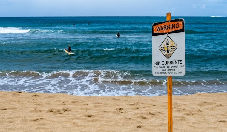
The National Weather Service has issued a High Risk of rip currents for northeast Florida and southeast Georgia beaches through Monday night into early Tuesday morning (until 5 a.m. EDT on May 19). NWS Jacksonville is warning of "Dangerous rip currents" with surf running about 3–4 feet. Swimmers are urged to stay close to lifeguards and to float or signal for help if they get pulled into a current instead of trying to fight it.
Lifeguards can close or restrict access to stretches of shoreline with little warning, so it is worth checking conditions before you pack up the car. Even if the skies look perfect, the water may not be.
Afternoon Storms and Gusty Winds
A slight chance of rain arrives early in the afternoon, mainly between about 1–2 p.m. From roughly 2–5 p.m., scattered showers and isolated thunderstorms are possible, especially where the Atlantic and Gulf sea breezes collide near the I-75 corridor.
At the beaches, southeast winds should run around 7–17 mph with gusts into the mid-20s. Any isolated inland storms could kick out stronger, erratic gusts that briefly derail outdoor plans. Drivers near the coast should be ready for choppy surf splashing near beachfront roads and sudden dips in visibility if a quick downpour rolls through.
What To Pack And When To Change Plans
Count on a sticky feel, with dew points in the low 70s, so bring plenty of water, some shade and a bit of patience. Sudden downpours can bubble up quickly after midday, even if the day starts off calm and sunny.
If you head for the shore, pick a lifeguarded stretch of beach and avoid going into the surf while the High Risk is in effect. For local details on beach tips and flagged trouble spots, see yesterday’s rip current rundown. Keep an eye on lifeguard postings and the National Weather Service for any last-minute closures or changes.
Quick Outlook
Monday looks sunnier and drier for most of the area, with east winds keeping coastal spots a few degrees cooler than inland neighborhoods. Daily afternoon storm chances are expected to return on Tuesday and ramp up through late week, with higher coverage possible by Memorial Day weekend.
Temperatures should hold in the mid to upper 80s at the coast and close to 90 inland. In other words, plan on a warm week with regular doses of afternoon pop-up storms trying to cut through the heat.


