Knoxville is waking up in a cloud this Saturday, with fog and mist cutting visibility and temperatures hovering near 70°F as humidity maxes out. Showers and thunderstorms are on the way before 2 p.m., and a Flood Watch is up for parts of East Tennessee through this afternoon. Morning commuters should expect slower drives and watch for standing water on low-lying roads.
Flood Watch Through This Afternoon
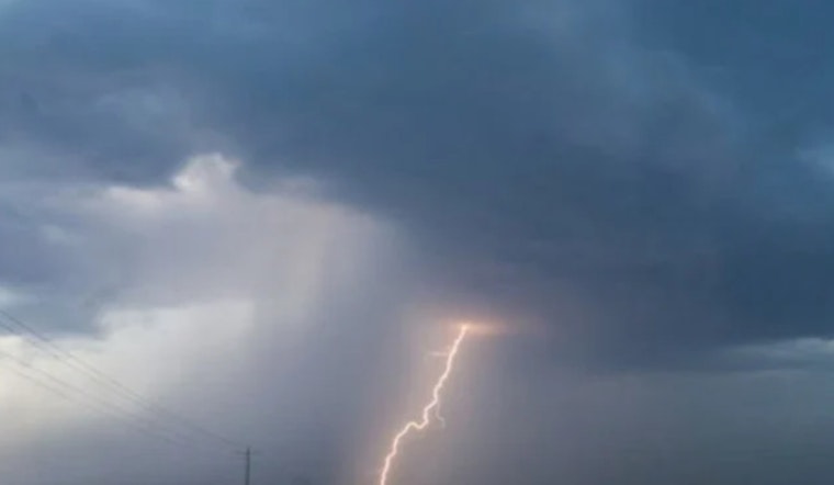
The National Weather Service in Morristown has a Flood Watch in effect through this afternoon for many East Tennessee counties, warning that repeated heavy downpours could trigger flash flooding on creeks, streams, and other low-lying spots. According to NWS Morristown, new rainfall totals between one-half and three-quarters of an inch are possible, and some storms could unload much higher amounts in a short burst. If you live near a small stream or in a known low spot, keep an eye on local forecasts and be ready to head for higher ground if water starts to rise.
When To Expect The Worst
Showers and thunderstorms are favored through the late morning into early afternoon, with the most widespread rain likely before about 2 p.m.; today’s high should still make it to around 81°F. Hour-by-hour guidance suggests rain chances ease up after mid-afternoon, although a few storms may hang around later in the day or make a comeback Sunday evening. Similar storm odds showed up in this week’s Memorial Day outlook; check out our earlier stormy Memorial Day forecast for context.
How To Stay Safe This Morning
On the roads, slow down and leave extra room for braking, and never try to drive through flooded stretches of pavement. Turn around, do not drown. If you can, put off nonessential trips until later this afternoon, keep your phone charged for weather alerts, and move vehicles and valuables to higher ground if you are in a flood-prone area. For more basic flood-safety tips, see the NWS flood safety page.
Short-Term Outlook
More rounds of showers and thunderstorms are possible Monday, but a drier stretch is expected to build in from Tuesday through Thursday, with lower humidity and highs near seasonal norms. That should finally give parts of East Tennessee a breather from the repeated downpours that have soaked the region this month.


