Milwaukee started Wednesday on a calm, almost sleepy note: clear skies, light winds, and about 61°F at 5:40 a.m. That quiet stretch will not last for folks near Lake Michigan. A backdoor cold front is slipping in from the northeast and is set to keep lakeside neighborhoods noticeably cooler than inland spots as the day wears on.
By afternoon, areas away from the lake are still expected to climb into the low 70s, while the immediate lakeshore hangs back in the mid-60s. At the same time, northeast winds will strengthen through the afternoon and into tonight, setting the stage for some rough water.
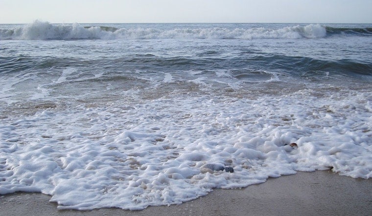
Beach Hazards Tonight
According to NWS Milwaukee/Sullivan, a Beach Hazards Statement is in effect Wednesday evening through early Thursday afternoon for lakeshore communities from Sheboygan down through Kenosha counties. The alert warns of life-threatening 3 to 6-foot waves and dangerous currents along the shoreline.
The same system is also prompting a Small Craft Advisory for open Lake Michigan waters as onshore northeast winds build this evening. Gusts along the shore could reach about 30 mph, while open-water gusts may approach 30 knots, or roughly 35 mph. The message from forecasters is blunt: “Stay out of the water and away from dangerous areas like piers and breakwalls.” Inland highs should top out near 73°F today, with mid-60s along the lake, before overnight lows slip into the upper 40s.
Afternoon Winds And Commute Impacts
Those brisk northeast winds will make the lakeshore feel a few degrees cooler than the thermometer suggests and could whip up tricky crosswinds on exposed lakeside roads. Cyclists and drivers of high-profile vehicles should keep a tight grip on the handlebars and steering wheel.
If you had plans for a lakeside evening, including time on a beach, pier, or breakwall, it is a good idea to move them inland or postpone. Lifeguards and park staff are urging people to stay out of the water and off structures while the waves and currents ramp up. Boaters are being told to take the Small Craft Advisory seriously and expect rough, choppy conditions until winds back off sometime Thursday afternoon.
Looking Ahead
High pressure builds in late Thursday and holds into the weekend, which should bring drier, calmer air and a warming trend, with highs reaching the mid-70s by Friday and into early next week. For more on how this week’s lake hazards started and evolved, including the earlier rip-current warning, see our coverage of how killer currents chill Milwaukee holiday start.


