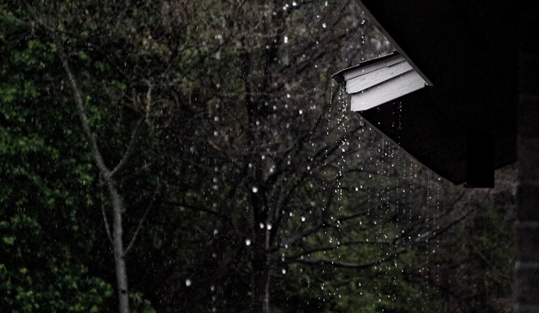
New Orleans is waking up mostly dry with temperatures in the mid 70s, but that quiet start will not last long. A Flood Watch is in effect Wednesday, May 27, through 7 p.m., and showers and thunderstorms are likely to roll through the metro during the day. Short bursts of very heavy rain could still turn low lying streets and yards into temporary lagoons.
What To Expect Today
Forecasters are calling for repeated rounds of showers and thunderstorms from mid morning into the afternoon, with the most active window roughly between 7 a.m. and 4 p.m. Highs should reach near 85°F. Most spots are expected to pick up around a quarter to a half inch of rain, although some neighborhoods could see heavier pockets that briefly overwhelm drains, according to the National Weather Service. Stronger storms could bring gusty, erratic winds and quick drops in visibility when the downpours hit.
Flood Watch And Impacts
The Flood Watch covers metro New Orleans and much of southeast Louisiana through 7 p.m. Wednesday. Because the ground is already saturated from earlier rain, even short but intense showers can trigger ponding on streets and localized flash flooding. The main concern is urban and poor drainage flooding, so low spots, underpasses and slow draining neighborhoods are the most likely places to see standing water that can make some routes impassable. If you come across a flooded roadway, the rule still applies: Turn Around, Don’t Drown.
Commutes And Outdoor Plans
Expect slower commutes and consider moving cars off low lying streets before the heaviest rain arrives. If you have outdoor plans, have an indoor backup ready, since many afternoon events could be disrupted by brief but intense storms. You can sign up for city alerts and flood resources through NOLA Ready, and it is a good idea to pad your schedule if you are traveling this afternoon.
Looking Ahead
Rounds of rain are expected to continue into Thursday, when forecasters anticipate widespread showers and thunderstorms with locally higher rainfall totals. Around a half to three quarters of an inch is possible in some areas. By late week into the weekend, the pattern should shift closer to typical summertime afternoon showers, although daily storm chances will linger into early next week, so keep an eye on forecasts if you have plans. Officials say widespread river flooding is not expected to repeat, while localized flash flooding and street flooding remain the primary concern.
Where We Got This
This update is based on forecasts and the Flood Watch issued by the National Weather Service, along with yesterday’s background coverage in our earlier post. For details on the previous round of watches and where the heaviest rain fell, see the May 26 coverage. We will post updates if warnings are upgraded or the watch is extended.


