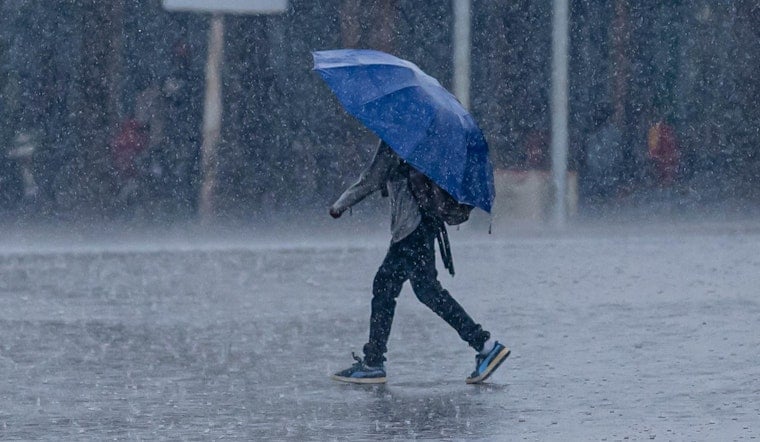
New Orleans woke up sticky and simmering Thursday morning, and the atmosphere plans to cash in on that humidity. Around 5:35 a.m. CDT on Thursday, May 21, 2026, the Lakefront (KNEW) was already reporting clear skies with a temperature near 75°F and a dew point around 73°F. That kind of tropical feel will fuel rounds of showers and thunderstorms today and right through the holiday weekend. Expect frequent downpours at times, with pockets of heavier rain that could briefly flood streets in low-lying neighborhoods.
When the Rain Shows Up
Scattered showers are possible before 7 a.m. CDT, with storms becoming more likely from mid-morning into the afternoon as temperatures head toward a high near 85°F. The National Weather Service puts today’s rain chances around 60% and notes that new rainfall totals of about a tenth to a quarter of an inch are possible, with higher amounts under the stronger storms. Southeast winds will stay light this morning, then pick up to around 5 to 10 mph during the afternoon. According to the National Weather Service, the steadiest rain and greatest thunder risk should run through the afternoon and into the evening.
Flooding Risk And What To Watch For
Forecast discussions call for several rounds of storms to sweep across the region every 18 to 24 hours, with meteorologists tracking a total of about 3 to 7 inches of rain over the next seven days for much of southern Mississippi and southeast Louisiana. Any one round can drop one to two inches of rain in a short window, and repeat storms over the same neighborhoods raise the odds of localized flooding and street ponding. There are no active watches or warnings in effect as of this morning, but forecasters say a Flood Watch may be needed later if storms start to organize. Keep an eye on changing conditions and avoid driving through standing water.
How This Affects Your Plans
If you have outdoor events lined up through Memorial Day on Monday, May 25, 2026, it is smart to have a backup plan indoors and to allow extra time for slow going on wet roads during commute hours. If your neighborhood tends to flood, move vehicles to higher ground before storms arrive and avoid driving through more than a few inches of standing water, since even shallow water can hide deeper hazards. For local shelter information and post-flood guidance, check NOLA Ready for tips and city resources.
Marine And Small-Boat Operators
On the water, boaters should prepare for light to moderate onshore winds of roughly 5 to 15 mph and generally choppy conditions. Thunderstorms can quickly turn that choppiness into hazardous gusts and higher waves. If a storm approaches, head to shore and wait for the line to move through before making another run.


