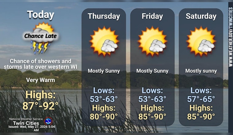
Minneapolis is heating up in a hurry on Wednesday, with abundant sunshine and afternoon temperatures pushing into the upper 80s and low 90s. Most neighborhoods will stay clear and dry, so if you are planning to be outside later in the day, bring plenty of water and be ready for the sun to stick around.
Afternoon Heat
Highs are expected to top out near 90°F by midafternoon, paired with a light east-northeast breeze and only a tiny chance of any local showers. The real storm action is projected to fire well to the east over central Wisconsin, leaving the Twin Cities mostly just hot and quiet. According to the National Weather Service, there are no watches or warnings in effect for the Twin Cities this morning.
Evenings And The Week Ahead
Tonight should be mostly clear with temperatures dipping to around 61°F, offering at least a modest cool-down after the daytime scorch. The warm spell sticks around, with highs expected to stay in the mid 80s to around 90 through Friday and into the weekend. Forecasters are calling for generally dry weather into early next week, so evenings may feel more comfortable while the daytime heat continues to hang on.
Where To Cool Off
If you do not have air conditioning, there are several public places to take a break from the heat. Libraries, community centers, and service sites are often used as daytime cooling locations. Check the Hennepin County cooling map for nearby options, and keep the basics in mind: drink water, avoid strenuous outdoor work in the midafternoon, and check in on older or vulnerable neighbors.


