Thursday kicks off clear and comfortable in Oklahoma City, with temperatures sitting in the mid‑60s at Will Rogers World Airport and a noticeable southeast breeze already moving things along. Do not get too cozy, though: the metro is set to heat up fast, with highs headed for the upper 80s by late afternoon as southerly winds build and make it feel a few degrees warmer than the thermometer shows.
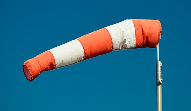
Afternoon Winds Pick Up
Forecasters expect south‑southeast winds to ramp up to 12–22 mph, with sustained speeds of 15–25 mph and gusts reaching into the low‑30s by late afternoon, especially across open terrain. That kind of breeze can tug at high‑profile vehicles and send loose yard gear on a short road trip, so patio furniture, trash cans and tarps should be tied down or brought in before winds peak, according to the National Weather Service Norman.
Red Flag Warning For Western Oklahoma
A Red Flag Warning runs from noon to 10 p.m. for parts of western Oklahoma where relative humidity is forecast to fall into the mid‑teens and gusty southerly winds could push any fire quickly. Residents west of I‑35 are urged to hold off on outdoor burning, keep grills and fire pits attended at all times, and report any smoke or flame immediately, per the National Weather Service Norman.
Storm Chances This Weekend
Storm chances this afternoon stay on the low side but are not completely off the table, as any high‑based cells that manage to develop across northern and western Oklahoma could produce strong, gusty winds and small hail. Rain and thunderstorm odds climb Sunday night into Monday, when a broader pattern change may deliver more widespread showers and a higher chance for stronger storms early next week.
Plan Ahead
Thursday and Friday look to be the hottest and windiest days of the stretch, and Friday could push low‑to‑mid 90s in parts of the metro and even higher readings in western Oklahoma before a cooldown arrives early next week. If you have outdoor plans, bring water, secure loose objects, avoid any open burning, and check the latest updates from local officials and the National Weather Service before heading out.


