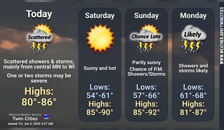
Minneapolis wakes up under partly cloudy skies and mild temps in the mid 60s this morning, with a light south southwest breeze nudging the day along. Patchy fog that hung around a few outlying airport sites earlier is expected to lift by mid morning. As the sun works on those clouds, the humidity will start to make itself known and highs are on track to climb into the low to mid 80s.
Afternoon Storm Chance
After a mostly sunny start, the atmosphere gets a little more restless this afternoon. A chance of showers and thunderstorms develops after noon, with the greatest coverage expected across central Minnesota into western Wisconsin and a high near 84°F. Any storms that do pop could bring brief heavy downpours along with localized damaging wind gusts or hail, although forecasters say widespread severe weather is not expected, according to the National Weather Service Twin Cities.
Tonight Through The Weekend
Scattered showers and a few thunderstorms may linger into early evening before skies clear out. Overnight lows should settle in near the low 60s. Saturday leans dry and sunny with a high near 87°F, a solid window for outdoor plans, while humidity builds back in on Sunday ahead of another round of showers Sunday night into Monday.
Heat Returns Midweek
Looking a bit farther out, forecast models and the latest discussion point to stronger ridging building by midweek. Highs are expected to jump into the 90s Wednesday and Thursday, with heat indices that could top 100°F, so it is a good idea to time outdoor activity for the mornings and take standard heat precautions. If you need a cool place during the hotter spells, Hennepin County publishes guidance and resources for heat relief and cooling options.


