A fast-moving wildfire roared across the hills above Lyle, Washington, on Sunday afternoon, triggering Level 2 and Level 3 evacuations and throwing a thick plume of smoke across the Columbia River into The Dalles. Strong west winds drove flames toward low-lying neighborhoods as crews from multiple agencies rushed in to defend homes, schools and key infrastructure. By late Sunday, officials said there were still no confirmed injuries or structure losses, but they warned that conditions remained highly unstable.
Authorities Issue Evacuation Orders
Klickitat County emergency management issued Level 2 ("Get Set") and Level 3 ("Go Now") evacuation notices for neighborhoods between State Route 142, Centerville Highway and the river, according to Klickitat County. Residents inside the evacuation zones were urged to leave along designated routes and the public was asked to stay out of the Lyle area so firefighters and law enforcement could move freely.
Variable Acreage Figures and Shelters
Portland's FOX 12 reported that crews estimated roughly 1,500 acres were burning by Sunday evening, and an American Red Cross shelter was opened at Columbia High School in White Salmon while information centers were set up at the Lyle Activity Center and Bible Baptist Church, as reported by KPTV. Local volunteers and county officials were on hand to help evacuees with immediate needs, from a safe place to sleep to basic supplies.
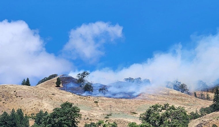
Weather Helped the Fire Spread
Local outlet Columbia Community Connection, citing the Columbia Gorge Wildland & Fire Information Page, reported that the blaze, dubbed the Lyle Hill Fire, was first called in at about 1:40 p.m. Gusty westerly winds then pushed the fire to estimates as high as 2,500 acres by midafternoon. The same report noted that winds were sustained around 27 mph with gusts up to 51 mph, a combination that shoved flames over ridgelines and down into drainages.
Air and Ground Response
An official with the Washington Department of Natural Resources told KPTV that as of 4:30 p.m. one crew and three engines were assigned to the incident. Local footage showed scooper planes and helicopters cycling through the smoke to make repeated water and retardant drops. Incident commanders said aircraft and hand crews were concentrating on keeping the fire from backing into the northwest side of Lyle while firefighters worked to carve out containment lines on the ground.
Road Closures and Trails
County and regional reports said Centerville Highway was closed because of fire activity, and hikers on the Lyle Cherry Orchard Trail were ordered back to their vehicles as conditions deteriorated, according to Columbia Community Connection. Temporary evacuation information centers were established at the Lyle Activity Center and at Bible Baptist Church in Goldendale to assist displaced residents looking for updates and resources.
How to Stay Informed
Klickitat County urged residents to keep an eye on its emergency page and official social media channels for updated evacuation maps, shelter information and real-time instructions, according to Klickitat County. Anyone needing shelter or assistance was directed to the county information points mentioned in public notices and to American Red Cross resources highlighted by local media.
The Lyle Hill Fire remains an active incident, and containment work was still underway Sunday night. Officials asked residents and onlookers to steer clear of the area while firefighters continue their push to corral the flames. This story will be updated as public agencies release new information.


