Milwaukee woke up in a gray blur Wednesday, June 10, 2026, as thick fog hugged the lakeshore, cutting visibility to around a half mile in spots and holding temperatures in the mid 60s. The murk should lift by midmorning, but the tradeoff will be a summer-style surge of heat and humidity, with a high near 86°F and multiple rounds of showers and thunderstorms expected later today and into Thursday. Morning drivers face reduced visibility, and anyone with afternoon or evening plans should be ready for storms that could snarl commutes and send outdoor events scrambling.
Foggy Morning
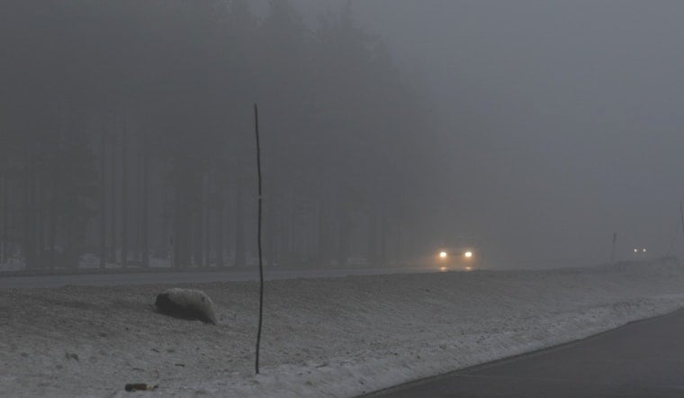
The National Weather Service has issued a Dense Fog Advisory until 7 a.m. CDT on Wednesday, June 10, 2026, for Sheboygan, Kenosha, Milwaukee, Ozaukee, Racine, Washington and Waukesha counties, warning that visibility can drop to a quarter mile in spots, according to NWS Milwaukee. The advisory stresses that sudden changes in visibility can make driving hazardous and urges motorists to “slow down, use your headlights, and leave plenty of distance ahead of you.” Low clouds and patchy fog near the lake are expected to hang on through midmorning, while inland neighborhoods warm and clear more quickly.
Afternoon Severe Storms
By Wednesday afternoon, south winds of 5 to 20 mph, with gusts up to 30 mph, combined with heat in the mid 80s, will help fire up showers and thunderstorms. The prime window for storms runs roughly from 1 p.m. to 6 p.m. Some of these storms could turn severe, bringing damaging winds and large hail, and forecasters are not completely ruling out a brief tornado. That setup tracks with the outlook in a wild week in the skies, so anyone headed to outdoor events should be ready for last minute cancellations or a quick move to shelter.
Heavy Rain Tonight
Storms are expected to linger into Wednesday night, with some pockets of heavy rain dropping 1 to 2 inches in localized areas. Widespread flooding is not anticipated, but poor drainage streets and low lying spots could see brief ponding, which means evening drivers should watch closely for standing water. Breezy winds will stick around, so plan for bursts of heavy rain and gusty winds that can make travel more challenging.
Beach And Lake Hazards
By midafternoon, conditions along Lake Michigan will turn rough, with a high swim risk expected into the evening. Higher waves and dangerous currents are likely at beaches in Sheboygan and Ozaukee counties, and swimming is not advised this afternoon. Mariners and beachgoers are urged to follow local notices, since thunderstorms moving over the lake can bring strong gusts and quick drops in visibility near shore. Surf and rip current hazards are expected to hang on into Thursday evening as onshore winds continue.
What To Do
If you have to drive in the fog this morning, ease off the gas, use your headlights, and give yourself extra space in traffic until conditions improve. For later in the day, try to shift outdoor plans to midmorning or be ready with a solid indoor backup. Before storms develop, secure patio furniture, check on event updates, and keep your phone handy so you can act quickly if warnings are issued. For the latest watches and advisories, check the National Weather Service and local updates before heading out.


