New Orleans is waking up to a classic Gulf Coast steam bath Monday morning, with cloudy, muggy conditions, temperatures around 82°F, and a Flood Watch already in place for much of the metro through at least Wednesday morning. Multiple rounds of showers and thunderstorms are lined up through midweek, with the most intense stretch expected from Tuesday into Wednesday. Repeated heavy downpours could trigger localized flash flooding and ponding on low-lying streets, so commuters should build in extra time.
Today Through Midweek
Forecasters are calling for a high near 90°F today with about a 50% chance of scattered showers and thunderstorms. Any storms that do pop up could bring brief heavy bursts of rain, dropping roughly a tenth to a quarter of an inch in spots. The setup gets more active Tuesday and Tuesday night, when storms become likely and some neighborhoods could see a quarter to a half-inch of rain or more in localized bands. Winds stay mostly light from the southwest to south, though a stronger southerly flow later this week could mean gustier conditions near the lakefront.
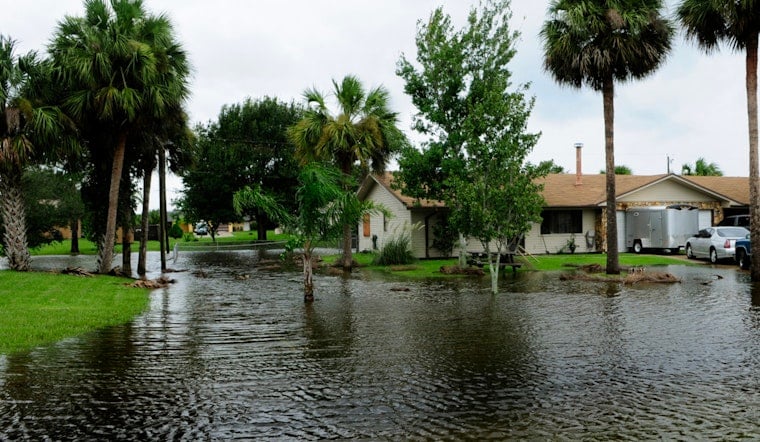
Flood Watch And What It Means
The National Weather Service has a Flood Watch posted through at least Wednesday morning for much of southeast Louisiana and parts of southwest Mississippi. With several rounds of heavy rain in the forecast, local drainage could struggle to keep up, which raises the risk of flash flooding. Drivers should avoid pushing through standing water and move vehicles off blocks that are known to flood when they can. For the official watch details and the latest updates, see the NWS New Orleans.
Local Impacts And Advice
Brief travel delays are likely during heavier downpours where water ponds on streets, and minor coastal ponding is possible at high tide around midweek. Residents can sign up for city alerts and preparedness guidance through NOLA Ready, and should remember the rule: Turn Around, Don’t Drown when faced with deep water. Anyone working outside or planning activities should be ready to move things indoors or keep a close eye on morning forecasts.
Outlook
The unsettled, humid pattern looks locked in through the weekend, with daily chances for showers and storms and highs mostly in the mid to upper 80s. Check forecasts before heading out, and expect updates to the Flood Watch if rainfall trends start to ramp up.


