Oklahoma City is waking up mostly clear and around 74°F this Friday morning, June 26, 2026, with a light south breeze and a whole lot more weather on the way. Showers and thunderstorms are possible tonight and again Friday afternoon and evening, and some of those storms could turn strong to severe. Once that pushes through, a hot, breezy pattern is set to park over the metro for the weekend.
Afternoon And Evening Storm Threat
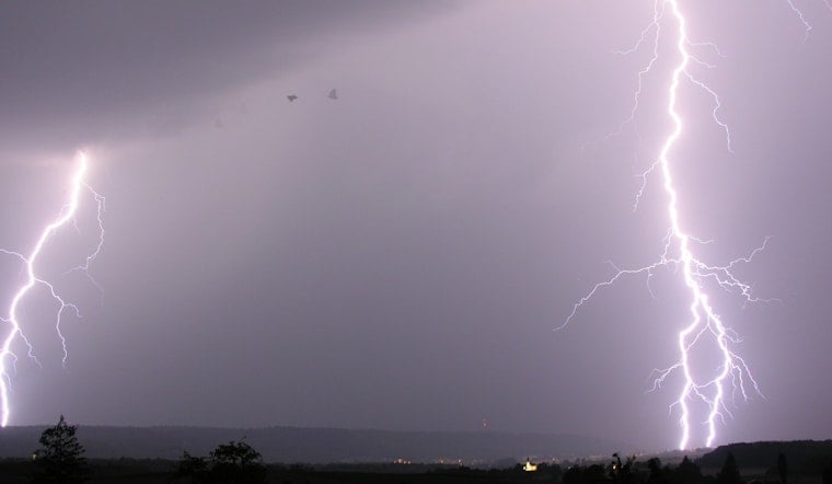
According to the National Weather Service Norman office, strong to severe storms are possible Friday afternoon and evening, with quarter-size hail, damaging wind gusts up to 70 mph in the strongest cells, and locally heavy rainfall. A Flood Watch remains in effect through 7 AM CDT Friday for parts of central and north-central Oklahoma. If you have outdoor plans this evening, be ready to head inside quickly and keep a close eye on any watches and warnings that pop up.
Heat Builds Into The Weekend
Temperatures climb into the mid-90s on Saturday and Sunday, with highs approaching the upper 90s early next week and a forecast high near 99°F by Tuesday. Heat index values could top 100°F at times. South winds will stay breezy, which might help a little with the feel of things but will also make midday outdoor activity uncomfortable and potentially unsafe if you are out too long or working hard. The City of Oklahoma City heat intervention guidebook has local tips and resources for staying cool if you have to be outside.
Winds, Timing, And What To Expect
South-southwest winds of roughly 10-20 mph with gusts into the 20s are expected today and Friday night, with gusts that could reach 30 mph on Saturday. Storm timing looks most likely in the late afternoon into the evening on Friday, with isolated showers possible earlier in the day. Secure loose outdoor items, keep pets and livestock well watered, and keep those stronger winds in mind if you are driving a high-profile vehicle.
How To Prepare
Keep your phone set to receive emergency alerts and check forecasts before heading out. Move events indoors if storms approach and avoid prolonged sun exposure during the hottest part of the day. Stay hydrated, look out for neighbors who may be more vulnerable to the heat, and monitor local updates in case watches or warnings change as storms and heat build in.


