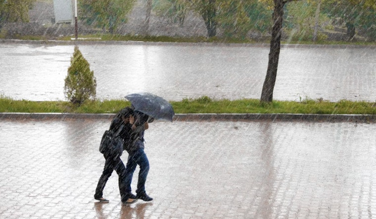
New Orleans commuters are staring down a soggy slog on Tuesday, after forecasters declared an Impact Day for the metro area with rounds of heavy downpours and scattered storms expected from afternoon into the evening. The strongest cells could dump rain so fast that water quickly ponds on low-lying streets and turns routine drives into stop-and-go headaches.
According to WDSU, meteorologists warn the storms could bring gusty winds, frequent lightning, waterspouts and small hail, and that any strong downpour may trigger localized street flooding across the region. The station's First Warning Weather team tagged Tuesday as an "Impact Day" because repeated cells could create anything from nuisance to dangerous ponding in neighborhoods with poor drainage.
Timing: two rounds, afternoon into evening
As outlined by the National Weather Service New Orleans/Baton Rouge, forecasters are watching for two main rounds of thunderstorms: an earlier coastal push from late morning into early afternoon, followed by a broader wave that should move through the metro from about mid-afternoon into the evening. The NWS briefing highlights that later round as the window when scattered, slow-moving cells could drop the heaviest rain and bring the greatest risk for localized flooding.
Local outlets are sounding the same alarm. WAFB notes that scattered showers should ramp up during the afternoon with elevated rain chances sticking around through the week, and FOX8 cautions that slow-moving cells may unleash torrential bursts of rain that overwhelm drains and quickly cut visibility on the roads. Both outlets point out that the humidity and warm temperatures will help fuel intense, short-lived downpours.
Flooding and city guidance
The city has urged residents to keep an eye on Streetwise and its emergency channels. As outlined by the City of New Orleans' NOLA Ready, officials recommend moving vehicles off known flood-prone blocks and sticking with the old but crucial advice: "turn around, don't drown" when you come across standing water. Streetwise offers real-time flood reports, and the city reminds residents that neutral-ground parking relaxations during high-water events are not a free-for-all to block transit lines or emergency routes.
What to expect on the commute
Drivers should be ready for quick hits of heavy rain, frequent lightning and gusty winds that can slow traffic and knock down small branches. Highs are forecast to reach the upper 80s to low 90s, keeping the air humid enough to feed repeated storm development. According to WDSU, the heaviest showers should taper overnight, although more daily rain chances remain in the near-term forecast.
Stay informed
Residents are encouraged to sign up for NOLA Ready alerts, monitor the National Weather Service and local stations for watches or warnings, and delay nonessential travel while storms are active. If you encounter flooded roads, find another route and report dangerous flooding through Streetwise or by calling 911 if the situation is an immediate emergency.


