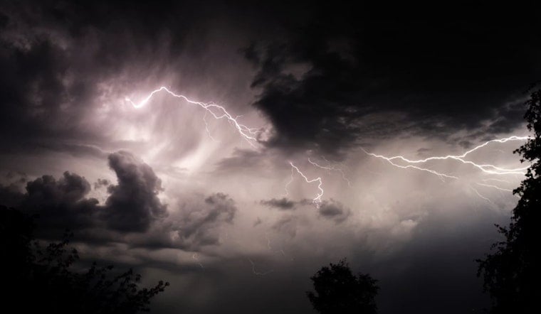
A fast-moving line of thunderstorms tore across northeastern North Carolina on Tuesday afternoon, triggering an updated severe thunderstorm warning and a flurry of urgent safety advice from forecasters. Racing northeast at about 45 mph, the storms packed strong, potentially damaging winds and frequent lightning.
What forecasters warned
At 2:56 p.m., the National Weather Service in Wakefield issued an updated severe thunderstorm warning, in effect until 3:45 p.m., for Bertie, Camden, Chowan, Currituck, Gates, Hertford, Pasquotank and Perquimans counties, according to the National Weather Service Wakefield office. Radar pegged the severe line from near Powellsville through Colerain to near Belvidere, all of it sliding northeast at roughly 45 mph.
“Expect damage to trees and powerlines,” the National Weather Service warned, noting that wind gusts could reach 60 mph. Residents were urged to move to an interior room on the lowest floor of a sturdy building. The office also asked people to report any storm damage or significant observations by calling 757-899-2415 or posting to the NWS Wakefield Facebook page or X @NWSWakefieldVA.
Where the line was heading
The warning spelled out a long list of communities in the crosshairs over the next hour. Forecasters highlighted Ahoskie, Hertford, Winfall, Ryland, Powellsville, Harrellsville, Tyner and Belvidere around 3 p.m., with Cofield and Hobbsville following minutes later. Other locations called out in the bulletin included Goose Pond, Whites Crossroads, Tunis and Arrowhead Beach, according to The News & Observer.
How this fits into the bigger picture
The speedy squall line was part of a broader severe-weather setup. The Storm Prediction Center had already put southeast Virginia and eastern North Carolina under an enhanced risk for severe thunderstorms, a category that bumps up the odds of damaging straight-line winds. Local briefings from the NWS Newport/Morehead City office framed Tuesday’s storms as one more piece of an active early-summer pattern.
Safety tips
Lightning and sudden wind gusts were the biggest immediate threats with this kind of fast-moving line. About 25 million lightning strikes hit the United States each year and roughly 20 people are killed annually, a statistic highlighted in The News & Observer’s coverage. Officials repeated familiar but crucial advice: stay away from corded phones and plumbing during storms, wait at least 30 minutes after the last rumble of thunder before heading back outside, and never drive through flooded stretches of road.
If you live in or are driving through northeastern North Carolina this afternoon, keep emergency alerts switched on and follow local emergency channels for the latest updates. Treat any downed power lines or visible storm damage as dangerous and report them to local authorities rather than trying to handle anything yourself.


