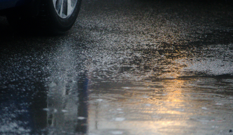
Strong thunderstorms muscled across Central Florida just before sunset on Sunday, May 31, unloading heavy rain, hail, and gusty winds on parts of Volusia and Brevard counties. The storms raced east from inland and slammed communities along the Space Coast, including Port St. John and Titusville. Forecasters warned that low-lying areas were vulnerable to flash flooding as the downpours produced localized street flooding and knocked down tree limbs.
According to WESH, First Warning Meteorologist Marquise Meda reported that some neighborhoods picked up 4 to 5 inches of rain. Hail up to about half an inch in diameter and wind gusts near 50 mph were also logged in northern Brevard County. WESH noted that forecast models were split, with the ECMWF showing a wetter signal for parts of the peninsula than the GFS, and that a low-pressure area over the Gulf could help keep storms in the mix through the week.
National Weather Service outlines primary threats
The National Weather Service office in Melbourne said the main immediate concerns were damaging wind gusts and frequent lightning, warning that gusty winds up to 50-55 mph and frequent lightning will be the primary storm threats. NWS Melbourne also flagged ongoing rip currents and marine hazards along the coast and urged boaters to stay alert for sudden cloud-to-water lightning strikes.
Models point to repeated heavy cells
The Weather Prediction Center has highlighted an elevated heavy-rain threat for parts of the Southeast this week as tropical moisture streams into the region. Public ECMWF model charts leaned wetter over Florida than the GFS in the short term, suggesting a higher chance of localized 2 to 4 inch totals where storms repeatedly train. For details, see the Weather Prediction Center discussion and ECMWF output at Meteologix.
Local impacts and travel hazards
Local broadcasters estimated that more than 50,000 people in northern Brevard County could feel impacts from the storms, and authorities warned that the I-95 corridor faces a flash-flood risk from standing water and overwhelmed drainage. Per WESH, first responders were keeping tabs on downed limbs and flooded streets in several neighborhoods and urged drivers not to attempt to cross flooded roadways.
Forecasters said the unsettled pattern is expected to stick around into midweek as a weak cold front slides south, boosting shower and storm chances on Tuesday and Wednesday. A brief cooldown is anticipated later in the week. Residents are advised to follow updates and any advisories from the National Weather Service in Melbourne and local media.


