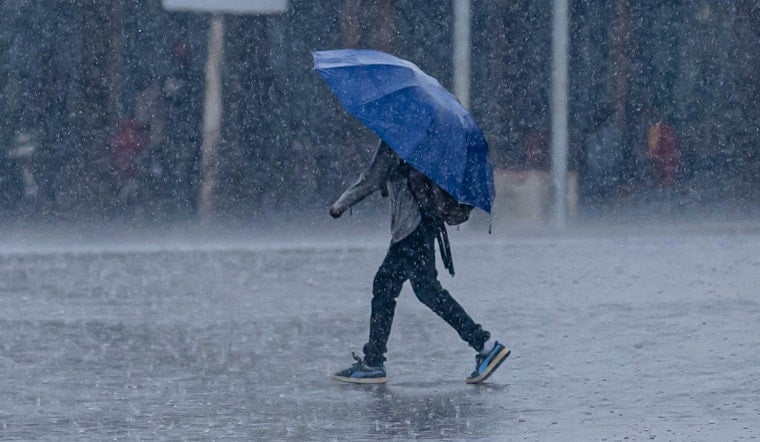
Clear skies and a cool start will be short lived as Milwaukee heads for a wet, windy Wednesday on June 17, 2026. Showers are on tap between 7 a.m. and 1 p.m., with heavier showers and thunderstorms likely from roughly 1–5 p.m., setting up a slow, soggy midday and afternoon commute. Temperatures will peak in the low 60s, and a southeast breeze will make the rain feel even chillier.
Afternoon Gusts And Commute Impacts
Rain will fall steadily and at times heavily, with south winds of 5–20 mph and gusts up to 30 mph expected. Some spots could pick up a half to three quarters of an inch of rain in a short stretch. Those gusts and downpours could cut visibility and create standing water in underpasses and other low-lying areas, dragging out the evening drive.
The National Weather Service in Milwaukee/Sullivan has the full forecast and has issued a Beach Hazards Statement and a Small Craft Advisory for the lakeshore this afternoon into late tonight, according to NWS Milwaukee/Sullivan.
Lakefront Hazards And Boating
Life-threatening waves of 3 to 6 feet and strong longshore currents are expected along Lake Michigan from Wednesday afternoon into late tonight. Local officials are urging people to stay out of the water and to keep clear of piers and breakwalls, where conditions can turn dangerous quickly. Boat operators are advised to secure loose gear and steer clear of nearshore waters while waves and currents remain hazardous.
For local beach updates and advisories, check the City of Milwaukee’s beach advisories page at City of Milwaukee.
Cool Turn Thursday Then Warmer Weekend
On the back side of this system, Thursday should turn mostly sunny with highs near 73°F, a solid rebound after today’s chill. The weekend looks warmer, with highs in the upper 70s by Saturday offering a more comfortable stretch for outdoor plans.
Another round of showers and thunderstorms is possible Sunday, so keeping an eye on the forecast before locking in late-weekend plans is a smart move. For today, keep the umbrella close and expect some delays for afternoon activities while storms roll through.


