

























































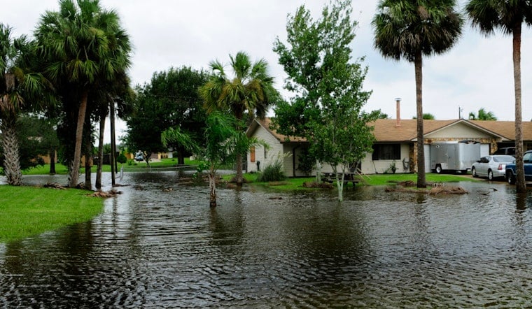
Thursday, July 23, 2026 - New Orleans rolled out of bed to partly cloudy skies and that familiar slap of midsummer humidity. Morning temperatures sat in the mid to upper 80s with the high expected to top out near 91°F. Scattered showers and thunderstorms are possible through mid-afternoon, with southerly winds around 15 mph and gusts near 25 mph giving commuters a bumpy ride on bridges and along the lakefront.
Coastal Flooding Rides In On Morning Tide
Minor to moderate coastal flooding has already been observed at several shoreline stations, and another two to three feet of water is expected with this morning's high tide, especially on low-lying shorelines. A Coastal Flood Advisory remains in effect until 10 AM CDT on Thursday, July 23, 2026, and a Tropical Storm Warning continues only for lower Terrebonne Parish and nearby coastal waters. Water is likely to spread over parking lots, beaches and low-lying roads in affected parishes, and a few spots could see isolated road closures. This advisory information comes from the National Weather Service in New Orleans.
Showers Hang Around As Bertha Bows Out
Expect a chance of showers and thunderstorms before 10 AM and again between 10 AM and 4 PM on Thursday, July 23, 2026, with most areas picking up between a tenth and a quarter of an inch of rain and a few pockets seeing heavier downpours. Winds will stay mostly out of the south near 15 mph with gusts up to 25 mph, which could briefly cut visibility on the roads and knock down a few small branches near the coast. Bertha's center is sliding westward away from the metro, so conditions should gradually turn drier later today as the pressure gradient relaxes. For background on the system's approach, see Gulf storm lurks offshore.
Heat Cranks Up Into The Weekend
Starting Friday and running through the weekend, from Friday, July 24 through Sunday, July 26, 2026, more sunshine will help push afternoon highs into the mid to upper 90s. Heat index values could flirt with 105 at times. Forecasters say Heat Advisories are likely for parts of the metro from Friday into the weekend, especially along the I-10 and I-12 corridors, so it is smart to schedule the hardest outdoor work for early morning or evening and drink plenty of water. If you do not have reliable air conditioning, consider heading to municipal cooling sites or call 311 for help finding one. For the full forecast discussion see the National Weather Service.
What It Means For Your Day
Give yourself extra time on morning drives near the lakefront and low-lying approaches, and do not try to drive through standing water, no matter how shallow it looks. Boaters should secure gear and follow any Small Craft Advisories that are posted, as marinas may still see higher waves and strong currents. Keep an eye on local alerts and NOAA Weather Radio through the morning, since watches and warnings may change if Bertha shifts. We will update this page if any watches or warnings change for the metro area.





