

























































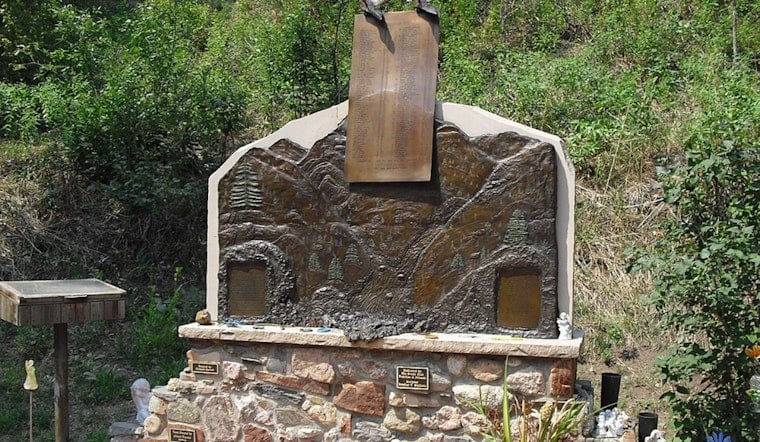
Fifty years after a sudden wall of water ripped through Big Thompson Canyon and killed 144 people on July 31, 1976, Northern Colorado is getting ready to look straight at one of its worst nightmares. On Friday, July 31, survivors, families and officials will gather to honor those who died and to wrestle with a blunt question: could a disaster like that hit the canyon again? The narrow corridor that once filled with unsuspecting motorists and campers still shapes how the region thinks about flash-flood danger and how fast alarms actually reach people in harm’s way.
That night, an intense thunderstorm parked over the canyon and unloaded as much as 7.5 inches of rain in about an hour. The burst of water roared downhill, tearing into the channel, shoving massive boulders aside and flattening buildings along the way. At the canyon mouth, the Big Thompson River surged to more than 31,000 cubic feet per second. By the time the water receded, hundreds of homes and businesses were gone, and 144 people were dead, a toll that researchers later confirmed made it one of the deadliest flash floods in U.S. history. According to the USGS, the speed, scale, and sheer violence of the flood still serve as a benchmark in mountain canyon hydrology.
Why forecasters were blindsided in 1976
In the days that followed, the National Weather Service took a hard look at what went wrong. A review found forecasters were working with limited radar coverage and had very few real-time reports as the storm exploded over the canyon. That meant precious little time to warn anyone below. The post-storm analysis flagged big gaps in observation networks and breakdowns in the warning chain, and it called for upgrades that would eventually change how agencies keep tabs on fast-building storms over the mountains. The 1976 NWS and NOAA post-storm report laid out those operational blind spots and the lessons that came out of them in detail, as summarized by NOAA.
How forecasting and warning systems have changed
In the half-century since, the tools have gotten far sharper. Doppler radar networks, denser rain gauge systems and higher-resolution weather models now give forecasters a much clearer, faster look at heavy rain as it forms and moves. The Colorado Climate Center is bringing scientists and emergency managers together on July 31 to walk through those advances and to talk frankly about where the system still falls short between spotting a storm and getting people to move. The symposium program and agenda are available through the Colorado Climate Center.
Could it happen again?
Experts are careful with their words here. The 1976 storm was extreme, but not outside the bounds of what nature can still throw at the Front Range. Big Thompson Canyon’s steep walls and tight channel leave it vulnerable to short, brutal cloudbursts that can flip almost instantly into catastrophic flash floods. Retired USGS hydrologists and later analyses have stressed that similarly rare storms remain possible in Front Range drainages.
As reported by The Denver Post, the combination of steep terrain, particular storm tracks and already saturated soils can still line up to produce flash floods of outsized magnitude. Research also shows that the most intense rainfall-driven flash floods in the Colorado Front Range are much more likely below roughly 2,300 meters, or about 7,500 feet, where heavy rain rather than snowmelt is usually responsible for the highest peak flows, according to the USGS.
Commemorations and local events
Communities tied to the canyon are marking the 50th anniversary with a full day of events on July 31. Larimer County is hosting a remembrance ceremony at the Pulliam Community Building in Loveland in the afternoon, and the Big Thompson Flood Memorial group plans an evening service at the Drake firehouse. The Loveland Museum is unveiling a new retrospective exhibit on the flood, capped with a public reception that night. Earlier in the day, the Colorado Climate Center’s symposium in Estes Park will bring together researchers, emergency managers and local stakeholders.
Schedules, locations and visitor details are posted by Larimer County, the Big Thompson Flood Memorial group and the Loveland Museum.
What to watch for along the canyon
Officials say the best protection still starts with paying attention. That means respecting watches and warnings, staying off low riverbanks when storms build and refusing to drive into floodwater. The National Weather Service slogan “Turn Around, Don’t Drown” may sound blunt, but it is accurate. With cell and radio coverage still hit-or-miss inside the canyon, emergency managers continue to push for multiple ways to receive alerts and a simple rule: if water starts rising fast, head for higher ground immediately.
The National Weather Service offers detailed guidance on flash-flood safety and explains what its different watch and warning products actually mean.
Half a century after that disastrous night, the Big Thompson anniversary serves as both memorial and reality check. Northern Colorado is far better equipped on paper than it was in 1976, but the canyon’s unforgiving geography and the punch that mountain storms can still pack mean one thing has not changed: vigilance, backed by the memory of what happened there, remains essential.



