Honolulu woke up to warm, breezy trade-wind weather on Saturday, July 4, 2026, with early temperatures sitting in the mid-70s. Forecasters are calling for highs near 85°F and mostly dry conditions across Oʻahu, aside from a few brief windward showers. Gusty east-northeast trades will be calling the shots for beach plans and backyard gatherings through the holiday.
Afternoon Winds Pick Up
East-northeast winds are expected to run around 15 to 21 mph on Saturday, with gusts that could top out near 29 mph, especially from midday into the afternoon. A Small Craft Advisory stays in effect through 6 PM HST Monday, July 6, 2026, covering the usual windy zones: Maalaea Bay, the Pailolo and Alenuihaha Channels, and portions of the Big Island coastline. For exact timing and any official watches or warnings, check the latest from the National Weather Service Honolulu.
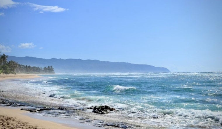
Marine Outlook
A moderate south-southwest swell will build into Sunday and Monday (July 5 and 6), nudging south-shore surf toward near High Surf Advisory levels. Expect larger sets and a higher rip-current risk at popular south-facing beaches. East-facing shores will stay rough and choppy while the trades hang on, so shoreline users should leave extra room for stronger waves and keep an eye on changing conditions. Lifeguards and shoreline advisories will post updated information if the surf or currents spike.
Fire Weather
Dry air mixing into the trades will knock afternoon relative humidity down to around 45 percent, which is enough to create moderate to locally near-critical fire weather concerns through early next week. The strongest winds are expected Sunday and Monday, so outdoor burning and unattended barbecues carry added risk. The Keetch-Byram Drought Index is still below the critical benchmark, but when humidity drops, local fuels become more vulnerable to ignition. Check official guidance and any local fire restrictions before lighting anything outdoors.
Plan For The Holiday
Heading to the beach or a park? Plan on securing umbrellas and canopies, and think twice before taking small boats across exposed channels, where the combination of trades and chop will be most noticeable. Expect gusty winds along the shoreline through Monday. Check the latest watches and advisories before you head out, and keep an ear on updates from local forecasters. For background on how this weekend's trade-wind pattern set up, see our July 1 update sticky trades whip Honolulu. Enjoy the holiday, but plan on blustery winds and choppy water sticking around into early next week.


