

























































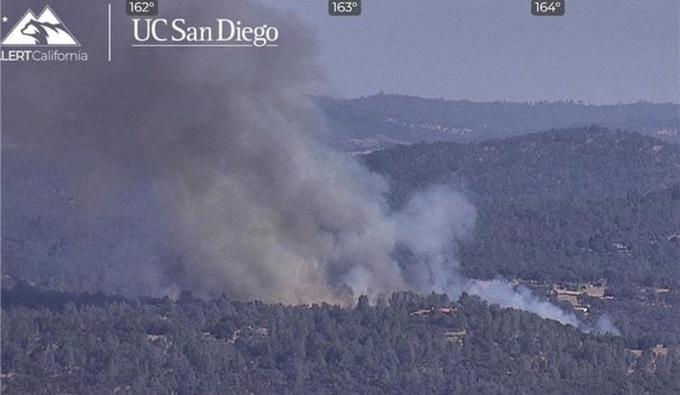
The Kearney Fire tore through dry Nevada County hillsides Tuesday afternoon, forcing evacuations and sending a surge of fire engines and aircraft into the area south of Highway 20 near Smartsville. Officials quickly ordered residents in two evacuation zones to leave and put several neighboring pockets on alert as the wildfire crept toward the Yuba County line, prompting calls for more air support and extra law enforcement to help manage the fast-moving situation.
Fire crews first arrived shortly after 4 p.m., and the wildfire-tracking service Watch Duty warned that the blaze was moving at a dangerous pace and throwing off multiple spot fires. On emergency radio channels, incident commanders requested help from the California Highway Patrol and called for a large air tanker, while Cal Fire’s online incident view showed several aircraft already working the scene. By about 4:45 p.m., the fire had grown to roughly 35 acres as crews worked aggressively to slow its advance, according to The Sacramento Bee.
Evacuation Zones And Maps
Authorities issued mandatory evacuation orders for zones NCO-E010 and NCO-E011, both located south of Highway 20 near the Yuba County line, and put additional areas north and east of the active fire under evacuation warnings. Nevada County’s emergency pages point residents to a live, zone-based evacuation map (Genasys Protect) and printable evacuation-zone posters so people can quickly confirm whether their address is affected. Those without internet access were reminded to dial 2-1-1 for help and to follow directions from deputies, firefighters, and other public-safety personnel, as outlined by the Nevada County Office of Emergency Services.
Where Evacuees Can Go
The county’s zone map and local reporting showed a temporary evacuation point at the Penn Valley Library, where displaced residents and animals could check in while firefighters worked to get a handle on the blaze. Officials also urged the public to steer clear of the fire area so both air and ground crews could maneuver safely and do their jobs without interference, according to The Sacramento Bee.
Crews, Resources And What To Watch
Into the evening, engines and aircraft continued building and reinforcing control lines, with a key focus on keeping the Kearney Fire from jumping Highway 20. Nevada County’s Ready dashboard and official emergency communication channels remain the go-to sources for verified updates, and officials said they will push out new information and any changes to evacuation orders or warnings as conditions shift. Residents are urged to keep checking the county’s incident page or call 2-1-1 for the latest official guidance.





