

























































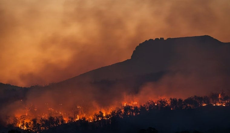
A wildfire discovered Saturday evening in Alpine County has already been classified as a Type 1 incident, the highest complexity rating in the national wildfire system, as crews work a blaze burning on federal land with no confirmed cause and no reported containment percentage.
The Woods Fire was first reported at 7:06 p.m. on August 8 in Alpine County, according to The Sacramento Bee. The fire is burning on federal land managed by the United States Forest Service, and as of the Bee's Sunday update, both the cause of ignition and the containment status remained undetermined. The National Interagency Fire Center classifies Type 1 as the most complex category a wildfire incident can reach, a designation that typically brings enormous resources to bear on a fire.
What a Type 1 Designation Actually Means
Type 1 incidents are not run like routine brush fires. Per the newspaper's report, these incidents often draw more than 200 operations personnel per operational period, and can exceed 500 — with total staffing on a Type 1 fire usually surpassing 500 people and sometimes topping 1,000. All command and general staff positions are activated, branches may be established to manage the incident's scale, and several types and numbers of aircraft are often involved in the firefighting effort.
The complexity extends beyond staffing numbers. A Type 1 incident requires a written action plan for every operational period and typically stretches across multiple such periods rather than resolving in a single push. Federal guidance further specifies that handing operational command of a fire this complex to a Type 1 Incident Management Team requires formal authorization at the Forest Supervisor level, coordinated with regional authorities, according to USDA Forest Service guidelines.
A County Built for This Kind of Emergency Strain
Alpine County is uniquely exposed to fires of this scale. It is California's least populous county, with an estimated 1,141 to 1,204 residents scattered across roughly 740 square miles, and it holds the lowest population density in the state at under two people per square mile, according to the Alpine County Chamber of Commerce. Roughly 96 percent of that land is publicly owned, which is why major fires here so quickly become joint operations between local volunteer departments, the state, and federal land managers.
Federal land within the county falls across three separate national forests — the Humboldt-Toiyabe National Forest's Carson Ranger District, the Stanislaus National Forest, and the Eldorado National Forest — a patchwork that demands close interagency coordination whenever a major incident breaks out, per the Alpine County Board of Supervisors. Non-federal fire protection and mutual aid across the county fall to the CAL FIRE Amador-El Dorado Unit, which also covers Amador, El Dorado, and Sacramento counties and works in joint command with federal agencies on complex fires.
A Dry, Lightning-Prone Summer Already on the Books
The Woods Fire is not an isolated flare-up. About two weeks earlier, on July 22, CAL FIRE AEU and Humboldt-Toiyabe National Forest firefighters responded to three separate lightning-caused ignitions — the Mud, Willow, and Picketts fires — in the county's Hope Valley area. All three were held under an acre, but the cluster underscores how active dry-lightning activity has been across Alpine County this season. CAL FIRE AEU has also kept its routine seasonal suspension on outdoor residential burn permits in place across Alpine, Amador, El Dorado, and Sacramento counties, a restriction that stays active until the unit chief lifts it based on weather and fuel conditions.
The county's history offers a stark reminder of what is at stake. In July 2021, the lightning-ignited Tamarack Fire burned 68,637 acres across Alpine County and western Nevada, destroyed 23 structures, and forced more than 2,400 evacuations near Markleeville and the Mokelumne Wilderness. Post-fire assessments credited the 234-acre Markleevillage Fuels Reduction Project, completed in 2019 with a grant from the Sierra Nevada Conservancy, with creating a protective buffer that helped save Markleeville from destruction that year.
Evacuation Logistics Remain a Persistent Concern
Alpine County's road network compounds the risk any time a major fire threatens the area. The county's primary corridors, State Route 4 and State Route 88, are prone to severe seasonal traffic gridlock during peak visitor weekends, creating bottlenecks on narrow two-lane mountain passes that can complicate both first-responder access and resident evacuations, as previously reported by Hoodline. The county has no incorporated cities and only a limited number of main roads serving its residents.
It is worth noting that this is not the first wildfire to carry the Woods Fire name in the region — a separate, unrelated 21-acre vegetation fire by that name burned in neighboring Tuolumne County in 2022 near Highway 108 and Highway 49, prompting temporary road closures and localized evacuations outside Sonora. As of the Bee's Sunday update, the exact acreage, containment percentage, and specific ranger district affected by the current Alpine County fire had not been determined, and no evacuation orders or highway closures tied to the blaze had been confirmed.




