Saturday, July 4, 2026, started off thick and soupy in New Orleans, with the airport clocking in around 82°F and dew points in the mid 70s that make it feel stickier than the thermometer suggests. Today’s Independence Day forecast calls for a hot one, with a high near 93°F and mostly sunny skies, plus just a slight chance of scattered showers or thunderstorms mainly between about 2 p.m. and 4 p.m. If you are heading downtown for the 9 p.m. fireworks, bring plenty of water and be ready to duck indoors quickly if a storm cell pops up.
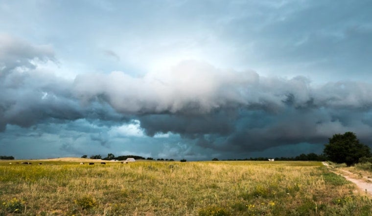
Afternoon Storms Could Crash The Party
Forecasters say any storms that do form will be highly hit or miss. Most neighborhoods should stay dry, but a few unlucky spots could see brief heavy downpours and gusty winds between roughly 2 p.m. and 4 p.m., when the chance of rain bumps up to about 20 percent. According to the National Weather Service, overall winds are expected to remain light at 0 to 5 mph, but any thunderstorm could kick out sudden, erratic gusts along with rain that quickly cuts visibility. The agency also flags the potential for waterspouts over coastal waters and warns that heat index values could climb to 105 to 110°F later in the week, with Heat Advisories possible as early as Tuesday. Check the latest outlook before you head out and have a quick shelter plan in mind, especially if you will be along the riverfront.
Heat And Safety
If you do not have reliable air conditioning, the city’s NOLA Ready site lists public cooling centers, recreation centers and hydration stations where you can get relief and water. Take frequent water breaks, avoid strenuous activity during the middle of the day, and keep an eye on local updates before committing to outdoor plans. Boaters and swimmers should move ashore if storms approach and follow marine advisories closely.


