

























































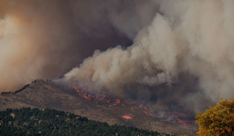
Portland and a big slice of Oregon are on track to bake starting Monday, with a high-pressure ridge set to push daytime highs above 90°F for at least four straight days. At the same time, active wildfires east of the Cascades are keeping smoke and danger in the mix. Fire managers in Central Oregon are already stretched thin after a lightning event sparked multiple blazes that merged into a complex and triggered evacuations, and large pyrocumulus clouds showed up clearly on satellite imagery and AlertWest cameras. The combination of hot temperatures, low humidity and gusty winds has led to elevated fire-weather outlooks and local warnings across parts of the state.
Heat wave timing and outlook
The heat wave is expected to kick off Monday and bring at least four, possibly five, consecutive days with highs above 90°F across inland valleys and neighborhoods, according to KATU. Meteorologists have flagged Monday through Thursday as Storm Tracker 2 Alert Days as the high-pressure ridge parks over the West. Forecasters say there is still some uncertainty about whether the heat hangs on into next weekend, but the early part of the week is locked in for uncomfortable temperatures.
Wildfires burning east of the Cascades
East of the Cascades, multiple lightning-ignited fires have combined into the Rowe Creek Complex in Wheeler County, prompting Level II evacuation notices for scattered homes and intensive structure-protection work, according to Central Oregon Fire Information. Local coverage from KTVZ notes that crews are focusing on defending homes while winds, steep terrain and limited resources make suppression a tough slog.
Fire weather outlook and warnings
The Storm Prediction Center has placed much of central Oregon under an Elevated risk for fire weather, which means any new ignitions could spread quickly in the expected conditions, according to the SPC. Forecast products from the National Weather Service offices in Portland and Pendleton show Red Flag Warnings and other heat and fire-weather alerts as hot, dry and gusty conditions hold on, per NWS.
What officials are advising
State and local health agencies are urging people to get ready for both extreme heat and potentially poor air quality: hydrate, check on neighbors, avoid strenuous outdoor work during peak heat, and use cooling centers if needed, according to the Oregon Health Authority. Fire agencies are also asking the public to skip open burning, follow current restrictions and keep tabs on local incident pages for the latest evacuation maps and closure information.
Conditions could shift quickly this week as thunderstorms return to some areas and the high-pressure ridge wobbles, so residents are urged to keep a close eye on local forecasts and official fire-information pages. If you live or recreate in fire-prone areas, have an evacuation plan ready and avoid travel into smoky zones until agencies say it is safe to head back in.




