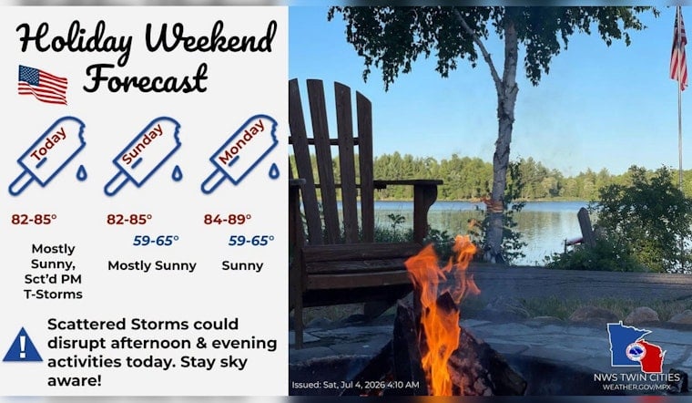
Minneapolis rolled into Saturday, July 4, 2026, wrapped in a blanket of humidity, with early morning temperatures in the upper 60s and dew points keeping the air stubbornly sticky. Skies are expected to heat up to a high near 85°F this afternoon. Most of the city should stay dry, but isolated showers or thunderstorms could pop up later in the day. Morning parades and fun runs look mostly safe, while evening outdoor plans might need a backup option on standby.
Afternoon Storms: Timing And Threats
Showers and isolated thunderstorms are most likely between about 2:00 p.m. and 10:00 p.m. on Saturday, July 4, 2026, with the best chances in the late afternoon and early evening. According to the National Weather Service, any storm that manages a strong updraft could deliver heavy rain and frequent lightning. A couple of storms may approach marginal severe limits, but coverage is expected to stay spotty. That means many neighborhoods will likely stay dry, while a few could see quick-hitting downpours and rumbles of thunder.
Plan For Parades, Fireworks And Transit
Morning events should be mostly in the clear, so early parades and fun runs can probably proceed without much weather drama. For evening fireworks and outdoor gatherings, though, organizers and attendees should keep plans flexible, since brief heavy rain can quickly cut visibility and send crowds scrambling indoors. Metro Transit will operate on holiday/Sunday schedules on July 4, and riders are advised to double-check service and build in extra travel time, according to Metro Transit. A bit of simple prep - a rain jacket, a waterproof phone case and a sheltered pickup spot - can make any last-minute weather pivot a lot less stressful.
Looking Ahead
Forecasters are calling for a brief break on Sunday, July 5, 2026, with mostly sunny skies and highs in the low to mid 80s before heat and humidity build again by midweek. Scattered afternoon showers and storms are expected to return by Tuesday and Wednesday, so anyone with outdoor plans later in the week should keep an eye on updates. Weather forecasts can shift, and more information on storm timing and coverage will be shared if it changes.


