

























































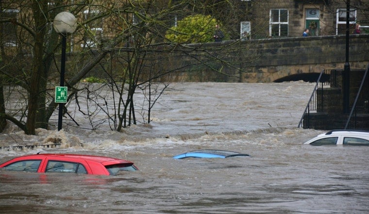
Parts of southeastern North Carolina woke up Thursday under a flood watch, with forecasters warning that repeated bands of heavy rain could push water into low-lying neighborhoods, small creeks and underpasses around Wilmington and farther inland toward Robeson and Columbus counties. Officials say the biggest concerns are flash flooding and water-covered roads that can quickly strand drivers and damage homes and cars.
What the watch covers
As reported by the Raleigh News & Observer, the watch covers inland Pender; coastal Pender; inland New Hanover; coastal New Hanover; inland Brunswick; coastal Brunswick; Robeson; Bladen; and Columbus counties and remains in effect through Friday afternoon. Local officials are keeping an eye on rainfall rates and will issue Flood Warnings if conditions start to go south.
What forecasters are warning
The National Weather Service in Wilmington warns that "flash flooding caused by repetitive periods of excessive rainfall is possible," and that excessive runoff may flood rivers, creeks, streams and other low-lying locations, according to the National Weather Service. Forecasters say training storms - bands of heavy rain that keep moving over the same spot again and again - are the main concern over the next 24 to 36 hours.
How much rain to expect
Guidance from the Weather Prediction Center and local forecast offices suggests many communities could pick up a couple of inches of rain, with localized pockets of 3 to 5 inches, which would be enough to trigger sudden flash flooding. The Weather Prediction Center specifically flagged the risk for localized 3 to 5 inch totals in a MetWatch discussion, and local reporting has echoed that threat for Thursday and Friday.
Safety basics: Turn around, don’t drown
The National Weather Service reminds people that six inches of fast-moving water can knock an adult off their feet, and just 12 inches can carry a small car, according to its flood safety guide (National Weather Service). That is why officials say to avoid driving through flooded roads, move to higher ground if you live in a flood-prone area and make sure you have a reliable way to get warnings overnight.
How to stay updated
Residents are urged to keep up with local forecasts, county emergency channels and NOAA Weather Radio for any Flood Warnings and road-closure notices. If you come across standing water on a road, turn around instead of trying to push through it, and report dangerous flooding to local authorities once you can do so safely.





