

























































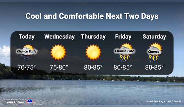
Minneapolis is waking up under cloudy skies and around 65°F Tuesday, but the city’s sticky summer air is about to get a reset. A cold front is moving through the region, bringing a brief chance of showers or thunderstorms before 7 a.m. and a noticeably cooler afternoon high near 76°F.
According to the National Weather Service Twin Cities, scattered showers should fade quickly after the morning commute, with northwest winds around 10 mph following the front. Skies will brighten into the afternoon, when temperatures climb through the upper 60s and low 70s before leveling off near the day’s high.
A Quieter, Cooler Night
Tuesday night looks partly cloudy, with temperatures dropping to around 58°F. Patchy smoke is possible before 7 p.m., though the forecast otherwise stays dry. Wednesday brings a sunnier day with a high near 78°F.
80s Return For The Weekend
Warmth returns Thursday, when sunny skies and a high near 82°F set the stage for a warmer Friday near 86°F. Rain chances increase Friday night through Sunday, with showers and thunderstorms possible and the best odds currently showing Saturday night and Sunday.
For Tuesday, the practical takeaway is simple: early plans may need a light rain layer, while afternoon outings should benefit from cooler, less humid air. The current forecast lists no watches or warnings, but storm timing can shift as the front clears the Twin Cities.




