

























































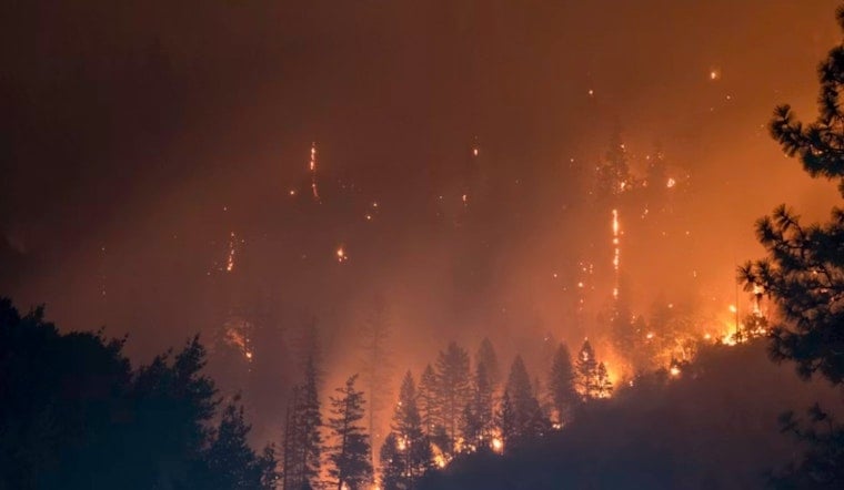
A vegetation fire estimated at 50 acres has shut down a stretch of US Highway 395 south of Gardnerville and pushed Douglas County officials to issue evacuation warnings for residents near Double Spring and the Leviathan Mine area. The blaze, dubbed the Double Spring Fire, broke out Friday night into Saturday, prompting road closures and reverse 911 alerts to nearby neighborhoods as crews scrambled to keep the flames from spreading further.
According to Douglas County, Nevada, US 395 south is closed at Ray May Way, while northbound lanes are shut at State Route 208, effectively severing the highway between Holbrook Junction and Gardnerville. That stretch is a critical link between Nevada's Carson Valley and California's Eastern Sierra, and its closure has cut off the primary route regional commuters, truckers, and tourists rely on, as reported by the Hindustan Times. Douglas County says crews and resources are actively responding to the fire, and a perimeter and evacuation map is available online through Perimeter Map for residents tracking the blaze's movement.
Evacuation Warnings Blanket Double Spring and Leviathan Mine
Evacuation warnings have been issued for Double Spring and the Leviathan Mine area, and emergency dispatch monitoring on Watch Duty confirmed that reverse 911 notifications also reached residents in Pinenut Estates as Level 2 “Set” warnings were established. Douglas County has directed residents to Watch Duty for current information, evacuations, maps, and more. The warning zone sits just outside a place with an unusual environmental history: the Leviathan Mine area includes a 250-acre abandoned open-pit sulfur mine that the EPA placed on its Superfund National Priorities List in May 2000 after decades of acid mine drainage polluted tributaries of the East Fork Carson River, according to the Leviathan Mine entry on Wikipedia. Federal and state agencies have run multi-million dollar containment systems at the site for years, though the dossier does not indicate whether any of that monitoring infrastructure has been affected by the current fire.
Firefighters Stretched Thin Across Northern Nevada
The Double Spring Fire erupted amid a broader wave of wildfire activity across Northern Nevada. Local crews were simultaneously responding to the more than 6,500-acre Bug Fire near Cold Springs and the 111-acre Moose Fire on Peavine Peak, according to KTVN 2 News. That kind of simultaneous strain puts pressure on regional firefighting resources at a moment when multiple communities need help at once. Douglas County's fire response falls primarily to the East Fork Fire Protection District, formed in 1981, which covers more than 600 square miles of the county and responds to over 7,000 calls a year on a budget topping $32 million for the current fiscal year, per the Western Fire Chiefs Association.
A Corridor With a History of Big Fires
This is not the first time this stretch of US 395 has been threatened by wildfire. In July 2021, the 58,000-acre Tamarack Fire tore through the same area, crossing US 395 near Holbrook Junction and forcing mandatory evacuations for Leviathan Mine Road, Double Spring, and Topaz Ranch Estates, according to KUNR Public Radio. A year before that, the Numbers Fire burned more than 17,400 acres southeast of Gardnerville in July 2020, forcing multi-day closures of US 395 to repair destroyed guardrails and infrastructure near Pine View Estates, per the Bureau of Land Management Nevada. Together, those two prior blazes underscore how vulnerable this transportation corridor has become to major wildland fire.
Where Residents and Animals Can Go
Douglas County's established emergency protocols designate the Douglas County Community and Senior Center in Gardnerville as the shelter for displaced residents, while livestock and other domestic animals are directed to the Douglas County Fairgrounds on Pinenut Road or to Dresslerville Park. Those same facilities were used during the 2021 Tamarack Fire evacuations, reflecting standard practice for the county's agricultural communities. The current fire follows weeks of elevated fire danger across the region; last month, Hoodline reported that the National Weather Service in Reno issued Red Flag Warnings for the Sierra front on July 10, citing afternoon wind gusts of 25 to 35 mph and relative humidity as low as 7 percent, prompting Douglas County to warn residents against outdoor target shooting or driving over dry grass.
Homeowners in the wildland-urban interface are encouraged to consult the University of Nevada, Reno Extension's Living With Fire program, which offers guidance on defensible space and rapid evacuation preparedness. As of the latest information, the exact cause of the Double Spring Fire's ignition, the timeline for reopening US 395, and whether any structures have been damaged remain unresolved. Residents in the affected zone are urged to monitor Watch Duty and county alerts for updates as the situation develops.


