

























































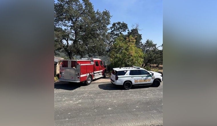
A fast-moving fire near Sierra College Boulevard and King Ranch Place forced mandatory evacuations across several Granite Bay neighborhoods on Saturday, with Placer County Sheriff's deputies going door to door to clear homes as firefighters worked to knock it down. The blaze broke out in western Granite Bay near the Roseville city limits, and authorities have not yet released an estimate of its size or said whether any structures have been damaged.
Deputies issued mandatory evacuation orders for residents along Cavitt Ranch Place, Hidden Valley Place, Baywood Road, J-Bar-B Drive and King Ranch Place, according to CBS Sacramento. The affected streets sit in a residential area clustered along Sierra College Boulevard, and firefighters were still responding to the fire as evacuations got underway, the station reported.
A Wildland-Urban Interface Under Constant Watch
The neighborhood sits squarely within a wildland-urban interface that fire officials have flagged for years as a hotspot. Granite Bay carries CAL FIRE's High and Very High Fire Hazard Severity Zone designation, a classification that subjects property owners to state-mandated defensible space rules requiring flammable vegetation to be cleared within 100 feet of structures, according to Gold Mountain California News. Dry foothill fuels in the area regularly present elevated ignition risk, per the same CBS Sacramento report.
The primary agency responsible for responding to blazes like this one is the South Placer Fire Protection District, which covers more than 55 square miles across Granite Bay and Loomis, per Placer LAFCO. The district is led by Chief Darin Snedeker, a 25-year fire service veteran and Granite Bay resident who took over in January after longtime chief Mark Duerr retired at the end of December 2025, according to reporting cited by the Placer Sentinel.
Budget Cuts Closed Two Granite Bay Stations
This fire comes amid an ongoing funding crisis for the district that has already reduced its footprint in Granite Bay. In May, the South Placer Fire District Board of Directors voted to place a $375 annual parcel tax measure on the November ballot, citing long-standing funding shortages that forced the closure of two Granite Bay fire stations — Station 15 on Treelake and Station 19 on Auburn Folsom Road — according to reporting referenced by Gold Mountain California News. Residential parcel taxes in Granite Bay had been fixed at $70 for nearly 50 years before the district sought the increase.
Whether those closures affected initial response times to Saturday's fire in western Granite Bay remains an open question. The district's remaining active facilities include Station 17 on Eureka Road and Station 16 on Olive Ranch Road, per Placer LAFCO's fire service review.
Recent Pattern of Sudden Grass Fires in Placer County
Saturday's blaze fits a pattern that has repeated across Placer County's foothill communities this summer. Just two weeks earlier, a fast-moving vegetation fire in North Auburn triggered sudden door-to-door evacuations off Atwood Road, with deputies clearing residents along Vista Roble Drive and Bean Road and a temporary shelter opened for those displaced. In June, a 3.7-acre brush fire near Bridgeway Court in neighboring Roseville led to the arrest of a 50-year-old suspect on felony arson charges after community tips helped a motor officer locate him near a trail.
The county has also invested heavily in longer-term wildfire prevention. Placer County earned a state Fire Risk Reduction Community designation in July for meeting wildfire prevention and land-use planning standards, a status that can help local homeowners under California fire insurance regulations. That followed a $2 billion, 10-year Regional Forest Health Countywide Action Plan approved in 2024 aimed at treating nearly 650,000 acres of dense, fire-prone vegetation stretching from the Sierra Nevada foothills to Lake Tahoe.
What Residents Can Do Right Now
Placer County public safety agencies use the Placer Alert system, powered by Everbridge, to send location-specific phone calls, texts and emails during immediate threats such as wildfires, a notification network that operates jointly across Placer, Sacramento and Yolo counties. Residents facing evacuation orders are directed to monitor the ReadyPlacer Dashboard for real-time evacuation maps and road closures, and to call 2-1-1 for shelter or animal evacuation assistance — a resource that logged over 3.3 million visits during past major fire events.
As of Saturday evening, authorities had not said whether any structures were damaged or offered an estimate of how large the fire had grown. Firefighters remained on scene working the blaze near Sierra College Boulevard as evacuations continued in the affected neighborhoods.





