

























































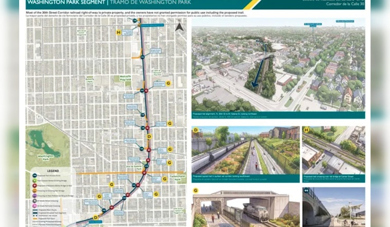
Milwaukee County has finally put a proposed seven-mile bike and pedestrian trail on the map, laying out a north-south connection between the Hank Aaron State Trail and Havenwoods State Forest. The route would cut through more than 20 Milwaukee neighborhoods, but it is still a planning document—not a construction announcement.
The Milwaukee County Department of Transportation unveiled the proposed alignment after three rounds of community and stakeholder engagement. According to the Milwaukee County Department of Transportation, the concept mixes rail-with-trail sections with neighborhood connections, park access, greenways and links to the regional trail system.
The route is intended to connect some of Milwaukee’s northwest-side neighborhoods to a broader network that includes the Hank Aaron, Oak Leaf and Beerline trails. The Milwaukee Journal Sentinel reported that proposed access points in Metcalfe Park include one near West North Avenue between North 30th and 32nd streets and another near West Wright Street off North 32nd Street.
The Route Is Proposed, Not Promised
There are still some very Milwaukee-sized complications between a route map and an actual trail. The county says portions running alongside the railroad would require approval from the railroad or other landowners, while sections near waterways could require floodplain approvals; future design and construction would also depend on funding, according to the county transportation department.
The trail is part of a longer-running effort to remake the 30th Street Corridor as a place with better mobility, public space and economic connections. The City of Milwaukee identified a 30th Street rail-with-trail project in its Connecting the Corridor strategic plan, which was approved by the Common Council in 2020.
Rails to Trails Conservancy has described the proposed corridor as a key piece of the broader Route of the Badger network, especially because many neighborhoods along the north-side route have limited access to biking and walking facilities. A completed connection could make everyday trips safer while also tying residential areas to parks, jobs and existing recreational trails, the organization says.
Public Comments Are Open Through August 28
Residents can review the proposed route through the county’s interactive map and submit comments until Aug. 28. The feasibility study is expected to continue into mid-2027, with 30% construction plans scheduled to be developed before officials decide what can actually move toward construction, the Milwaukee Journal Sentinel reported.





