

























































Minneapolis is starting Monday with clear skies, temperatures in the mid-60s and a pleasant summer forecast that turns more unsettled after dark. The city should warm to about 82°F before showers and thunderstorms enter the picture Monday evening.
Afternoon Winds Pick Up
Monday afternoon looks sunny to mostly sunny, with west-southwest winds increasing to around 10 mph. The rain chance stays near zero through most of the day, making for comfortable conditions for errands, commutes and outdoor plans.
Storm Chances Arrive Monday Evening
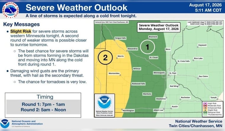
A 40% chance of showers and thunderstorms arrives between about 7 p.m. and 1 a.m., according to the National Weather Service. Skies will turn mostly cloudy, temperatures will settle near 65°F, and rainfall should generally remain light, with new amounts under a tenth of an inch possible.
Forecasters say scattered storms will develop across parts of western Minnesota late Monday and move east-southeast through the evening. A strong storm or two cannot be ruled out, with the greater concern focused across western Minnesota rather than the Minneapolis area, so it will be smart to keep an eye on the sky if you're out late.
Cooler And Showery Tuesday
Tuesday brings a noticeable cooldown, with a high near 77°F and a 30% chance of rain showers from about 7 a.m. to 4 p.m. The forecast then allows for a chance of showers and thunderstorms later in the day, with light northwest winds around 5 mph.
Another 30% chance of showers and thunderstorms is possible Tuesday evening before skies clear overnight. The low should fall to around 59°F, setting up a cooler and quieter start to Wednesday.
Sunny Weather Returns Midweek
Wednesday is expected to be sunny with a high near 78°F, followed by another sunny day Thursday near 82°F. Rain chances increase again Thursday night into Friday, when storms are possible, but the weekend currently looks mostly sunny with highs close to 80°F.





