

























































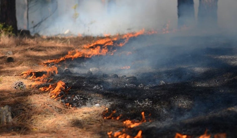
A new wildfire broke out on private land in Mariposa County Friday evening, igniting at 5:50 p.m. with a cause that remains undetermined. Dubbed the Haul Fire, the blaze had no available containment information as of the latest update, leaving residents and fire watchers with more questions than answers heading into the weekend.
The fire's discovery was reported by the Sacramento Bee, which cited the National Interagency Fire Center as the source confirming the ignition. The Bee's report, credited to its CA Wildfire Bot and last updated Friday at 6:32 p.m. after first publishing six minutes earlier, did not specify the fire's acreage, threatened structures, or evacuation status. Those details remain open questions as the incident develops.
Fires breaking out on private land in Mariposa County fall under the jurisdiction of CAL FIRE's Madera-Mariposa-Merced Unit, known as MMU, which serves as the primary fire protection agency across more than 2 million acres of State Responsibility Area spanning Mariposa, Madera, and Merced counties. The unit has had a busy summer already: crews fully contained the 1,280-acre Fields Fire in neighboring Snelling in late July, and just weeks before that, suppressed the 90-acre Day Fire burning off Highway 140 and Owen Dam Road near Catheys Valley.
A Pattern of Ignitions Across the Foothills
The Haul Fire is not an isolated event for the region. Earlier this year, a separate blaze known as the Midpines Fire erupted on private land near the Sierra foothill community of Midpines, a Yosemite gateway along Highway 140 — a fire Hoodline covered in an earlier ignition near Yosemite. Mariposa County's rugged terrain, heavy brush loads, and high summer temperatures have made it a recurring hotspot for wildland fire activity in recent years.
That history includes some of the county's most destructive fires on record. The July 2022 Oak Fire near Midpines scorched 19,244 acres and destroyed 193 structures, including 129 homes, making it one of Mariposa County's most devastating blazes, according to Wikipedia. More recently, the summer of 2024 brought back-to-back major fires, including the 791-acre French Fire in July and the 3,793-acre Pedro Fire in August, which threatened 350 structures and disrupted electric utilities across Mariposa and Tuolumne counties.
Defensible Space Rules and Local Fire Mitigation Efforts
Much of the fire risk in Mariposa County centers on private property where state law imposes strict requirements. Under California Public Resources Code Section 4291, property owners in State Responsibility Areas are legally required to maintain 100 feet of defensible space around homes and combustible structures, per DefensibleHome, with intensive clearing mandated within the first 30 feet and fuel thinning required out to 100 feet.
Local officials have also moved to formally acknowledge the danger. In September 2025, the Mariposa County Board of Supervisors unanimously adopted updated CAL FIRE maps designating Very High Fire Hazard Severity Zones across state responsibility areas countywide, according to CivIQ, a move that allowed the county to seek inclusion on California's Fire Risk Reduction Community list and pursue state wildfire-mitigation grants. Community groups have also built physical defenses, including the Alta Vista Fuel Break, which the Mariposa Fire Safe Council says protects more than 1,600 homes located in Very High Fire Hazard Severity Zones.
To help meet the demand of another active fire season, CAL FIRE's Madera-Mariposa-Merced Unit re-hired 35 seasonal firefighters through an academy at the Castle Fire Center in February. As of Friday evening, no containment percentage, acreage estimate, or information about threatened structures had been released for the Haul Fire, and it remains unclear how quickly crews will be able to establish a line around the blaze.





