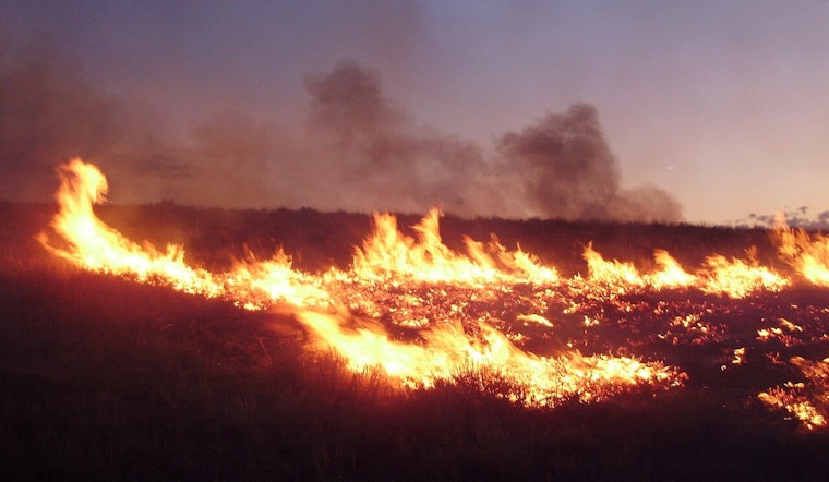
A new wildfire broke out on federal land in Los Angeles County Monday evening, prompting an initial alert that lists both its cause and containment status as unknown. The blaze, dubbed the National Fire, was discovered at 6:35 pm on land managed by the U.S. Forest Service, according to the National Interagency Fire Center.
The report was first published by the Sacramento Bee, whose article credits its automated CA Wildfire Bot, described as using AI based on newsroom-created templates that are reviewed and edited by journalists. That system pulls raw incident data directly from federal fire databases to generate early alerts before ground crews finish confirming details on scene.
Because the fire remains in what fire agencies classify as the initial attack phase, precise metrics like burn acreage and containment percentage typically stay listed as unknown until crews build and hold a control line around the perimeter, per National Interagency Fire Center standard operating procedures. That data gap is standard for early-stage wildfire reporting, not necessarily a sign of an especially severe or fast-moving blaze.
Automated Alerts Carry a Known Error Margin
Readers should treat these first-wave, machine-generated alerts with some caution. Hoodline previously reported that the same Sacramento Bee bot generated an inaccurate notice in March for a non-existent “Santa Fire” in Ventura County after pulling mislocalized data from New Mexico. State fire officials have cautioned that automated media bots can occasionally push raw database entries before fire perimeter teams confirm on-scene details.
Federal land in Los Angeles County falls under the Angeles National Forest, which spans more than 650,000 acres across the San Gabriel and Sierra Pelona mountains and buffers open space for nearly 18 million regional residents, according to the USDA Forest Service. The forest, established as a federal reserve in 1892, contains some of the steepest and most fire-prone mountain terrain in the country.
Closest Forces Protocol Guides Initial Response
When a fire ignites on that federal terrain, interagency policy in Southern California calls for a closest forces protocol that lets the Los Angeles County Fire Department and the U.S. Forest Service dispatch joint resources across jurisdictional boundaries immediately, transitioning to unified command if the fire grows, the USDA Forest Service notes. The county fire department typically leans on specialized brush patrol trucks, helitenders, and hand crews — including inmate fire crews stationed at Fenner Canyon Conservation Camp inside the Angeles National Forest — to build containment lines in terrain too steep for bulldozers.
The National Fire ignited amid a stretch of intense wildfire activity both locally and nationally. The United States remained at National Preparedness Level 5, the highest tier on the national five-point scale, on the day the fire was reported, meaning wildland firefighting resources and aircraft were heavily committed across Western states with international crews mobilized to help, per the National Interagency Fire Center. That same day, federal fire agencies logged 101 new wildland ignitions nationwide within 24 hours while managing 98 uncontained large blazes staffed by nearly 30,000 firefighters.
Part of a Busy Summer for LA County's Foothills
Los Angeles County had already seen several significant wildland fires on federal forest land earlier in the 2026 season, including the Summit Fire near Llano, which burned 2,690 acres before reaching full containment in mid-July, according to CAL FIRE. The National Fire also follows closely on the heels of two other recent local ignitions: the Ridge Fire, which erupted near Gorman Post Road, and the Tasha Fire near Newhall Pass, which Hoodline reported was the third Santa Clarita blaze in a day.
Backcountry ignitions in the Angeles National Forest have a track record of escalating quickly. The September 2024 Bridge Fire scorched more than 50,000 acres across Los Angeles and San Bernardino counties after starting with zero initial containment, a reminder of how steep canyon topography and dense chaparral can challenge early suppression efforts.
The new fire also arrives as the county continues recovering from the January 2025 Palisades and Eaton fires, the most destructive wildfire event in county history, which burned over 23,000 acres and destroyed more than 6,800 structures. State officials approved $200 million in infrastructure and utility fire-resilience funding for Los Angeles County last month, money currently designated for utility undergrounding and fire hydrant replacements in those burn scars.
No information on injuries, evacuations, or structures threatened by the National Fire was included in the initial report. Hoodline will update this story as containment figures, cause determinations, and acreage estimates become available from fire officials.