

























































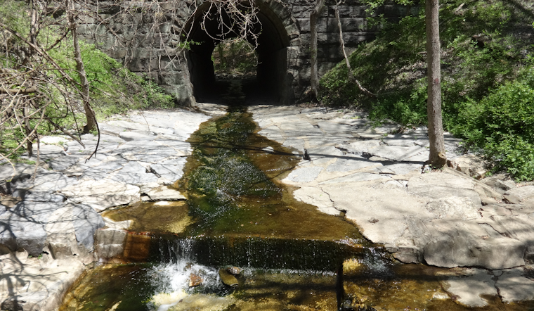
Patapsco Valley State Park is planning to open 10 miles of new trails and build a pedestrian footbridge connecting the underused Woodstock area to parking near McKeldin, a move aimed squarely at relieving the chronic overcrowding that has plagued Maryland's oldest state park since the pandemic. The park's Avalon area reaches capacity and temporarily closes to visitors about every weekend, while Woodstock, just a few miles up the river, sits largely empty because it has so few parking options.
The disparity has become a defining management headache for the 32-mile-long park, according to The Baltimore Banner, which reported that the park drew roughly 1 million annual visitors before the pandemic and now sees somewhere between 1.5 million and 2 million visitors a year. Rob Dyke put it simply to the outlet: people found the park during the pandemic and did not forget about it. The park spans Anne Arundel, Baltimore, Carroll and Howard counties and relies on visitor revenue for about 70% of its operating budget, according to the same report.
A Footbridge to Redistribute the Crowds
The centerpiece of the plan is a pedestrian footbridge that will connect Woodstock to parking lots in the McKeldin area, changing how visitors reach a section of the park that currently has almost no parking of its own. The footbridge project is set to open to bids Monday, and park officials hope to award a construction contract before the end of 2026, per Joe Vogelpohl, who told the Banner that officials want to draw people from developed areas into the underused Woodstock area. The nonprofit Friends of Patapsco Valley State Park expects to begin work on the new trails and footbridge in September, per the Banner's reporting.
Jim Miller described Woodstock's current state to the outlet as a place that can have only about a dozen other people present at any given time — a stark contrast to the packed weekends at Avalon. The Friends group has secured $650,000 in grant funding and donations to build more trails in Woodstock, the report notes, and the group already organizes six public trail work days each year that include both building new paths and maintaining existing ones.
Trails Through Quarries, Ruins and a Horror Movie Set
The new trail system is designed to accommodate a wide range of users at once: people with mobility issues, non-English speakers, horseback riders, and people hiking with grandchildren. The Friends of Patapsco Valley State Park plans to install trilingual signage in English, Spanish, and Korean along the new routes, according to the same report. Woodstock offers views, swimming and fishing spots, and natural areas that have been spared from invasive species, along with old ruins, overlooks and rock formations that give the section a very different character from the park's busier zones.
Those new trails will pass a granite quarry, a filming location for The Blair Witch Project, and a stone bridge built by Jesuit priests, the Banner reported. The Woodstock and Granite district's quarries once produced Woodstock Quartz Monzonite, a stone used in the late 19th century in major national construction projects including the Washington Monument and the Library of Congress, according to Wikipedia. The unincorporated community was originally named Waltersville before being renamed after its primary stone export. The Jesuit stone structures in the area trace back to Woodstock College, a theological seminary established along the river in 1869 that operated for a century before closing in 1969 and transferring its grounds to the state park system, per the Archdiocese of Baltimore.
The Griggs House, where the climactic final scenes of the 1999 horror film were shot, once stood in the park's Granite sector but was ultimately demolished by the state in 2003 after heavy fan foot traffic caused structural safety hazards. Dave Ferraro described the work of laying out the new paths to the Banner as a discipline that combines art and science.
Building on Maryland's First Adaptive Trail System
Patapsco already holds a notable distinction: it's home to Maryland's first adaptive trail system, and the Friends of Patapsco Valley State Park is building adaptive trails specifically for people with accessibility challenges. The Friends group completed 5 miles of adaptive trails in the McKeldin area in 2024, a network comprising the Poplar, Plantation and Switchback trails built with widened surfaces, outslopes capped under an 8% grade, and specialized cross-slope drainage to safely accommodate handcycles and adaptive equipment, according to Baltimore Fishbowl. That earlier project was funded in part by an $87,545 federal Recreational Trails Program grant awarded in 2023, as reported by MDOT News. Adaptive trails are typically wider and smoother than standard natural-surface paths, and none of the park's current projects have an official completion date, the Banner noted.
The push for more multi-modal and pedestrian connections tracks with a December 2023 Maryland Department of Natural Resources study on state park capacity, which recommended developing new final-mile trail connections to address post-pandemic congestion at heavily visited sites like Patapsco, according to a report filed with the Maryland General Assembly's Department of Legislative Services. Across its eight developed zones, the park already features more than 170 miles of natural-surface trails, with 70 miles formally designated as maintained multi-use paths for hikers, mountain bikers and equestrians, per Maryland's Department of Natural Resources. Established in 1907 as the Patapsco Forest Reserve after an initial 43-acre land donation, the park is Maryland's oldest and encompasses more than 16,000 acres.
The park's investment in accessible, redistributive infrastructure isn't new. Its paved Grist Mill Trail, a popular 1.5-mile route along the river for families and visitors with mobility needs, underwent a 12-month closure starting after Labor Day 2022 for major footbridge repairs. Maryland's Program Open Space also added more than 25 acres of newly acquired land to the park's Howard County boundaries in fiscal years 2021 and 2022, part of a longer-running state strategy to expand buffer zones around the aging park.





