

























































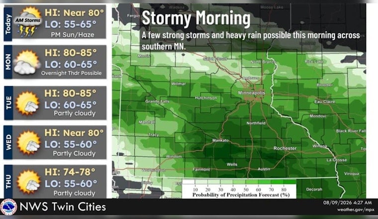
Minneapolis is starting Sunday under cloudy skies near 70 degrees, with showers and thunderstorms continuing through the early morning. The storms should taper by late morning, giving way to a mostly cloudy afternoon and a high near 83 degrees.
Storms Fade Before Sunday Afternoon
The National Weather Service Twin Cities says a few storms could produce frequent lightning, gusty winds and hail ranging from a quarter-inch to a half-inch. Rainfall totals of roughly a quarter-inch to a half-inch are possible, though the storms are expected to move along quickly enough to limit widespread flooding concerns.
The best chance for rain is before sunrise, with a lingering chance of showers and storms through about 11 a.m. Winds should stay light outside of thunderstorms, shifting from the west-southwest during the day, and no watches or warnings are posted for the area.
Monday Brings A Break Before More Early-Week Storms
Sunday night should turn partly cloudy with a low near 64 degrees, followed by a partly sunny Monday and a high near 85. Monday evening looks mainly dry at first, but showers and thunderstorms could return later at night.
Another chance for storms arrives early Tuesday, mainly before 7 a.m., before the sky turns mostly sunny and temperatures again reach about 85 degrees. Wednesday stays fairly warm near 82, with only a slight chance of a morning shower or thunderstorm.
Cooler Air Arrives Later In The Week
The weather pattern settles down from Thursday onward, with mostly sunny skies and highs near 78 degrees Thursday and Friday. Overnight lows should fall into the lower 60s in Minneapolis, while the broader region could dip into the upper 50s.
For Sunday plans, the morning is the part to watch: keep outdoor activities flexible, avoid exposed areas if thunder approaches, and expect slick roads during any downpour. By afternoon, the forecast looks much more manageable, with warmer temperatures and at least some breaks in the clouds.




