

























































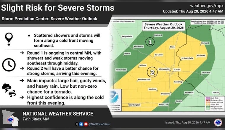
Minneapolis is starting Thursday, August 20, with clear skies and temperatures around 63 degrees, but the calm opening has an expiration time. Sunshine will push the city to about 83 degrees, with southwesterly winds strengthening through the afternoon before scattered showers and thunderstorms arrive late in the day.
Storm Chances Build After 4 P.M.
The National Weather Service Twin Cities/Chanhassen puts rain chances at 20% Thursday afternoon, rising to about 30% Thursday evening. Storms are most likely after 4 p.m. and could linger in spots through roughly 10 p.m. A few could become strong to severe, with large hail and gusty winds the main concerns.
Friday And Saturday Turn Calm Again
Once the front moves through, Friday should bring mostly sunny skies, a high near 80 degrees and northwest winds of 5 to 10 mph. Friday night will be mostly clear with a low around 62, followed by a sunny Saturday topping out near 80. Saturday night looks cooler, with temperatures dipping to about 58 degrees.
Comfortable Weekend, More Rain Chances Next Week
Sunday stays mostly sunny and mild near 80 degrees, with light winds making it a good bet for parks, patios and other outdoor plans. Monday should reach about 81 degrees before a 30% chance of rain showers arrives after 7 p.m., while Tuesday could bring another round of showers or an isolated thunderstorm with a high near 84.
No watches, warnings or advisories are currently in effect for Minneapolis. Anyone with evening outdoor plans should keep an eye on the sky and move indoors if thunder develops, especially as the stronger storms could bring hail and sudden wind gusts.





