

























































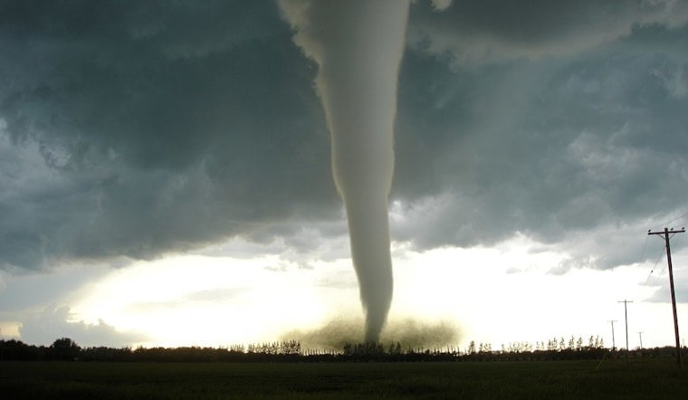
A tornado warning covering New Hanover and Pender counties was in effect until 5 p.m. Friday, with forecasters tracking a severe thunderstorm capable of producing a tornado and hail as large as an inch in diameter. The storm was located over Ogden near Wrightsville Beach and moving northeast at 10 mph, putting Figure Eight Island, Bayshore, Murrayville, Ogden, and Porters Neck in its path.
The National Weather Service office in Wilmington released an updated tornado warning for the two counties, as reported by the Charlotte Observer. Forecasters said tree damage was likely and warned that flying debris could be dangerous to anyone caught without shelter, while roofs, windows, and vehicles were all at risk of damage. Quarter-sized hail — the meteorological threshold the National Weather Service uses to classify a thunderstorm as severe — was part of the incoming storm, according to the agency's own criteria, which require wind gusts of at least 58 mph, hail of at least one inch, or a tornado before a storm earns that designation, per the National Weather Service.
What to Do if You're Caught Outside or in a Vehicle
People outside were told to seek immediate shelter inside a secure building, according to the report. Those indoors were advised to head to a basement, safe room, or interior room without windows, while anyone in a basement or on the lowest floor of a sturdy building was urged to stay away from windows entirely.
At workplaces or schools, the guidance was to avoid windows and large open rooms and to follow tornado drills, proceeding quickly and calmly to shelter, the outlet's report noted. Drivers were told to head to the closest shelter, and anyone outdoors, in a mobile home, or in a vehicle was advised to move to the closest substantial shelter — since sheds, storage facilities, mobile homes, and tents are considered unsafe tornado options and mobile homes could be damaged or destroyed. If someone couldn't reach shelter by vehicle, the recommendation was to get down in the car and cover their head, or to seek shelter in a ditch or ravine.
Why the Alert Might Not Have Reached Every Phone
Notably, a base-level severe thunderstorm or radar-indicated tornado warning like this one does not automatically trigger a Wireless Emergency Alert on mobile phones. Under National Weather Service damage-threat standards updated in 2021, automatic smartphone alerts only fire when a storm reaches the “Destructive” tier — meaning hail of 2.75 inches or winds of 80 mph — according to the National Weather Service. That gap is why safety guidance consistently urges residents to follow local news or a NOAA Weather Radio for updates rather than waiting on a phone alert.
Coastal North Carolina carries a documented tornado history that makes storms like this one worth taking seriously. In NWS Wilmington's forecast area, which covers coastal southeast North Carolina and South Carolina, tornadoes caused 333 injuries, 20 fatalities, and $97.4 million in property damage between 1991 and 2021. Pender County alone has recorded 47 confirmed tornadoes since 1950, averaging roughly 0.6 per year, with April typically the most active month, according to NOAA storm records. The county saw a confirmed tornado as recently as March 2025, when a twister cut a 3.15-mile path between Currie and Burgaw near Malpass Corner, damaging roofs, trees, and outbuildings.
Coastal Tornadoes Can Form Over the Ocean
New Hanover County emergency management guidance notes that coastal tornadoes in the Cape Fear region frequently begin as tornadic waterspouts over the ocean before moving onshore near communities like Wrightsville Beach and Ogden — and those waterspouts carry the same destructive potential once they make landfall. New Hanover County saw this firsthand in September 2019, when an EF0 tornado spawned by Hurricane Dorian tracked 2.47 miles near Wrightsville Avenue and Burnt Mill Creek, according to NOAA's National Centers for Environmental Information.
Anyone who spotted hail or wind damage was asked to report it to the National Weather Service office in Wilmington at 1-800-697-3901, the Charlotte Observer's report said.
Building an Emergency Kit
FEMA's preparedness guidelines, cited in the report, recommend a basic disaster supplies kit stocked with water — one gallon per person, per day, for at least three days — along with at least a three-day supply of food. The agency also recommends including a cell phone with chargers and a backup battery, a battery-powered or hand-crank radio, a manual can opener, local maps, a flashlight, a first-aid kit, a whistle, and a dust mask. Additional recommended items include moist towelettes, garbage bags and plastic ties for sanitation, plus plastic sheeting and duct tape.



