

























































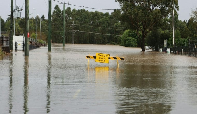
The path through Bothin Marsh floods roughly 30 times a year, and the businesses at Tam Junction are already counting the damage. In December 2024, eight inches of brackish water poured into the Junction Beer Garden in Mill Valley, and Proof Lab took on six inches of water in January when king tides and heavy rain hit at once. The 100-acre marsh, which stretches roughly three-quarters of a mile along Richardson Bay between Tam Junction and Mill Valley, faces ongoing inundation and erosion.
That erosion is not just a scenic problem. As reported by The San Francisco Standard, the marsh serves as both a habitat for migratory birds and a waterfront passage for cyclists, and its slow collapse is stripping Southern Marin of a natural buffer against the bay. Bay Area sea levels have risen about one foot over the last century, according to the cited report referenced in the Standard's account. The marsh's changing shoreline and sediment dynamics have shaped the landscape over time.
A Decade of Planning, a Levee That Already Breached
One Tam has spent nearly a decade developing a plan to improve Bothin Marsh's resilience, and the group has assembled nearly $4 million from public and private sources toward that effort, per the Standard's reporting. The stakes became visible in December 2024, when a Richardson Bay tide breached the levee at Tam Junction during a storm. The Junction Beer Garden alone incurred $5,000 in water-damage cleanup costs from that event. The subsequent condition of the levee and the beer garden's flood history are not established here.
Warren Wells has described the marsh path as crucial and discussed its flooding. The marsh's condition has drawn attention as sea-level rise worsens. Marsh-path flooding already severs cyclist and pedestrian access between San Francisco, Southern Marin, and the rest of Marin County when tides run high, cutting off a route that many walkers, runners, and cyclists use daily, according to Rails to Trails Conservancy.
The Fix: Sediment, Sand Beaches, and a Higher Path
The fortification plan calls for rerouting and raising the multiuse path to withstand three feet of sea-level rise and a possible 100-year storm, and it may include incremental sediment layering alongside erosion-resistant coarse-sand beaches, per the same account. The San Francisco Bay Restoration Authority has already backed the concept: in May 2024 the agency awarded a $1.7 million Measure AA grant to the Golden Gate National Parks Conservancy to advance Phase 2 planning, 65% design work, and environmental review for what the agency calls the Bothin Marsh Evolving Shorelines Project, building on an earlier $255,000 Phase 1 conceptual grant the authority approved in 2021. Conceptual designs include nature-based beach and ecotone features meant to absorb wave action.
The marsh also holds the largest population in San Francisco Bay of Point Reyes bird's-beak, a rare native plant, and provides critical habitat for federally listed bird species including the Ridgway's rail and California black rail, according to the California Native Plant Society Marin Chapter. Severe sea-level rise threatens to erode those vegetated areas into bare mudflats, the chapter notes. A geomorphology and ecology study has helped lay groundwork for the adaptation effort now underway.
Why the Timeline Stretches Years, Not Months
Marin County Parks and the Golden Gate National Parks Conservancy are now preparing environmental documentation for the Bothin Marsh Adaptation Project, targeting public review under the California Environmental Quality Act in 2027, according to Marin County Parks. The project is entering the state and federal environmental review phase, and full construction is expected only after environmental approvals, design finalization, and additional fundraising. The project's ultimate cost and funding needs remain to be determined.
The article's sources frame adaptation as an interim response while communities consider longer-term solutions. State projections cited by the California Native Plant Society Marin Chapter say inundation at Bothin Marsh could reach up to eight feet by 2100, and tidal flooding poses risks to buildings and roadways.
Immediate Pressure From This Winter's Tides
The urgency is not purely long-term. Coastal projections cited in the Standard's report say San Francisco Bay king tides will reach seven feet this winter, and experts have warned that a super El Niño could bring stronger storm systems, higher tides, and flooding as soon as October. Climate scientists and National Weather Service forecasters warned in August that a strong El Niño pattern combined with climate change could produce the highest sea levels on record in California, according to KQED, exacerbating winter tidal flooding across low-lying North Bay shorelines. That warning echoes the storm surges and king tides that already submerged Marin roadways in January, when flooding caused $4.35 million in infrastructure damage, according to a Marin County spokesperson.
Additional sea-level rise would increase the number of days the marsh path floods, a scale of disruption that could effectively end its use as a daily commuter route. The adjacent Caltrans Manzanita Park & Ride lot is susceptible to tidal surges and high-tide closures. The nearby Highway 1 off-ramp under Highway 101 is part of the transportation network around the marsh. Flooding and inundation pose risks to transportation infrastructure around Tam Junction and Marin City.
A Regional Funding Gap Looms Over the Project
Bothin Marsh's slow-moving fix sits inside a far larger regional challenge. The project is part of a broader effort to adapt Bay Area shorelines to rising seas. Shoreline adaptation is also being considered elsewhere in the region.
In a survey of about 850 community members conducted by One Tam, 87% of respondents reported experiencing flooding on the Mill Valley-Sausalito Pathway, with a strong majority favoring path realignment to maximize wetland ecological benefits over simply adding distance to the route. That local appetite for nature-based fixes lines up with what regulators are now reviewing on paper, even as the marsh keeps flooding in the meantime. For the cyclists, runners, and commuters who cross it, the wait for a permanent fix will likely span several more winters of king tides before construction ever begins.





