

























































Minneapolis woke to clear skies and temperatures near 70 degrees Monday, but the calm start will not last all day. Labor Day will turn warm and breezy before thunderstorms move in during the evening and overnight.
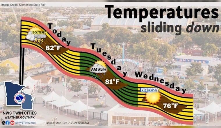
The high should reach about 81 degrees, with partly sunny skies and south-southeast winds of 5 to 15 mph. Gusts may reach 25 to 35 mph, so patio umbrellas, loose decorations and anyone hauling a grill may want to keep a hand on things, according to the National Weather Service.
Storms Arrive Monday Night
Showers and thunderstorms could begin around 8 p.m. Monday, with the chance increasing through the late evening and overnight hours. The forecast calls for a 90% chance of precipitation and roughly three-quarters to 1 inch of rain, while localized totals could exceed 2 inches if storms repeatedly track over the same areas.
The strongest storms could produce gusty winds and hail, though the overall severe-weather risk is considered marginal. Heavy rain and localized flooding may be the bigger concern, especially for low-lying areas and streets that collect water quickly.
Tuesday Starts Wet Before Skies Clear
Showers and thunderstorms are likely early Tuesday, mainly before 8 a.m., with additional chances lingering through around noon. Temperatures may still climb to about 81 degrees before clouds gradually break, followed by a much quieter stretch.
Wednesday looks sunny with a high near 75 degrees, though northwest winds could gust to around 30 mph. Thursday rebounds to about 80 degrees under sunny skies, while another round of rain chances arrives late Friday into the weekend as temperatures trend cooler.





