

























































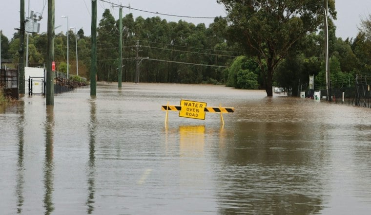
Flash flooding tore through Greenlee County, destroying a street crossing in Clifton, burying roads in Duncan under as much as three feet of water, and forcing the closure of U.S. 70 as the Gila River surged well beyond its normal monsoon-season depth. Late monsoon storms battered the eastern Arizona county, triggering both severe flooding and a landslide that added to the chaos on the highway.
According to eacourier.com, the National Weather Service reported that significant flash flooding was occurring over much of Greenlee County, with U.S. 70 closed as the Gila River was expected to rise further. The outlet reported that the Campbell Street crossing at Carlisle Wash had been destroyed, while Sand Wash was also seeing significant flash flooding. The flash-flood warning covered Route 70 between mile markers 342 and 385, and forecasters said between 1 and 3 inches of rain had already fallen in the warned area, with another 1 to 2 inches possible.
Per the same eacourier.com report, flooding along the Gila River was expected to worsen. As reported by FOX 10 Phoenix, the Gila River rose from about 1 foot — its normal monsoon-season depth — to at least 16 feet in the flooding.
Duncan Roads Swamped, Landslide Snarls U.S. 70
FOX 10 Phoenix reported that floodwaters covered some local roads in Greenlee County by up to 3 feet, with major flooding submerging some Duncan roadways under as much as 3 feet of water. The station noted that every road and creek in the area was running heavy, and that flooding in Duncan was worse this year than usual.
A landslide struck Duncan, temporarily closing a roadway and creating dangerous conditions on U.S. 70, according to the FOX 10 Phoenix report. A shoulder embankment blocked roadways on the highway, and the Arizona Department of Transportation temporarily closed U.S. 70 before clearing the landslide debris. The outlet also reported that rushing water knocked about 40 telephone poles into a culvert, and that a wash overflowed directly onto U.S. 70, prompting authorities to shut the highway down. Greenlee County Sheriff Eric Ellison shared footage showing heavy flooding across the region and urged everyone to avoid driving through floodwaters, per FOX 10 Phoenix.
The same station reported that the Duncan dike faced a potential breach, and that Duncan would flood if the dike failed. Separately, FOX 10 Phoenix reported that the San Francisco River was rising rapidly near Clifton and that officials might close Clifton's floodgates — a move the outlet said would separate Morenci and Clifton from access points and could trap some residents on opposite sides of the wall.
Clifton's Levee System Isn't a Guarantee
Clifton's flood defenses exist precisely because of days like this one. The town has partnered with state and federal agencies to construct flood walls, levees, gates and more, according to the Town of Clifton. But that infrastructure comes with a caveat: while the levee along the San Francisco River lowers flood risk, it does not completely eliminate it, GilaValleyCentral reports.
Clifton Town Manager Ian McGaughey told GilaValleyCentral that even with the levee in place, there is a chance of overtopping or failure, even though officials consider that risk low. The Town of Clifton also notes a quirk of local geography: because the San Francisco River flows down from New Mexico, there can be blue skies over Clifton while the river itself is rising.
A 1983 Flood Still Looms Large
Local accounts of the levee system point back to a single benchmark event. The San Francisco River in Clifton jumped its banks during what was considered a 100-year flood in October 1983, according to The Gila Herald. Many homes and businesses in South Clifton were badly damaged or destroyed by floodwaters that reached as much as 10 feet deep, the outlet reported, and GilaValleyCentral has reported that the river flowed at an incredible 90,000 cubic feet per second during that flood.
Accounts of the levee and floodgate system's history differ. The Gila Herald reports the gates had been in place since 1994, while GilaValleyCentral reports the levee and gates project was completed in 1994. The two outlets also describe the floodgates differently — The Gila Herald puts one of the two giant gates at about 15 feet tall, while GilaValleyCentral describes the Clifton gates as about 20 feet high.



