

























































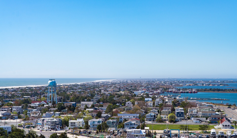
New NOAA data shows the north end of Brigantine and a long stretch of Long Beach Island would sit underwater at high tide with just 2.5 feet of sea-level rise, a threshold New Jersey could reach well within this century. Large sections of Cape May, Cape May Point, Wildwood, Stone Harbor and Avalon face the same fate at that same 2.5-foot mark, according to the data. At 5 feet of rise, New Jersey's barrier islands would be reduced to tiny slivers, and at 7.5 feet, they would be almost completely gone.
That grim math comes from an analysis by NJ.com, which compiled NOAA data into a tool showing potential sea-level impacts across the state, with the article written by Matthew Enuco. NOAA projects Atlantic City could see anywhere from 2 feet of sea-level rise by 2100 at the low end to as much as 7 feet at the high end, a range that reflects just how uncertain — and potentially severe — the outlook has become. The city currently sits at a sea-level rise rate of about 0.17 inches per year, or roughly 1.7 feet per century, according to NOAA data cited in the report.
New Jersey already has one of the fastest rates of sea-level rise along the Atlantic coast, per NOAA. Rutgers University's Impact publication explains why: the mid-Atlantic coastline has been slowly sinking since the last ice age, a process called glacial isostatic adjustment, compounding the effects of global ocean expansion caused by ice melt and thermal warming. At Atlantic City specifically, sea level has risen more than 1.5 feet since tide gauge tracking began in 1912, more than double the global average rate, according to Rutgers University Impact.
Roads and Bridges Face Regular Inundation
Jonathan Delura's analysis, cited by NJ.com, found that coastal roads and bridges could be regularly inundated at high tide over the next 25 to 75 years, with New Jersey coastal roads and bridges near the Delaware River especially at risk of vanishing. In Cape May County alone, Delura's analysis found more than 53 miles of roads would flood by 2050 under a 2-foot sea-level-rise scenario, a number that balloons to 216 miles flooded at high tide by 2100 if seas rise 4 feet. Ocean County would fare similarly, with about 70 miles of roadway flooded during average high tide by 2050 and 404 miles flooded by 2100 under the same 4-foot scenario.
Atlantic County isn't spared either — Delura's analysis found more than 170 miles of its roads would flood at high tide by 2100 under 4 feet of sea-level rise. Cape May County's hurricane evacuation routes would see almost 12 percent, or more than 19 miles, inundated under that same 2100 four-foot scenario. Experts told NJ.com that coastal inundation will flood roads and bridges and limit access to some places twice daily within 25 years, and Delura said most if not all coastal communities will be impacted daily if sea-level rise continues at its current pace.
According to the New Jersey Department of Environmental Protection, New Jersey coastal counties have experienced over $970 million in property damage and crop loss from coastal storms and flooding since 1960. The New Jersey Office of Emergency Management's State Hazard Mitigation Plan records that tidal flooding forced the closure of schools and roads in parts of coastal New Jersey on May 12 and 13.
Atlantic City's Decades-Long Defense
Atlantic City has already spent $300 million on infrastructure improvements since Superstorm Sandy, according to the NJ.com report. That includes rebuilding a $70 million seawall around the city's north end, adding three new pump stations, and maintaining compliance with FEMA flood regulations. Brian Kempf, the city's planner, is the one building seawalls to hold increasing tides and rising sea levels at bay, work meant to protect the roughly 40,000 residents who call the city home along with the tourists who visit.
“The city must remain viable for future generations,” Kempf said, according to NJ.com's reporting. Researchers quoted in the same report warned that New Jersey coastal communities could suffer debilitating tidal flooding twice daily, and some could be completely underwater by 2100. Even so, both experts and state officials told NJ.com that irreversible damage has already been done despite emissions reductions and infrastructure adjustments — and that Atlantic City itself could be partly underwater within 75 years if sea levels reach scientists' worst-case projections.
Cape May's Seawall and the Sand Problem
Further south, Cape May plans to extend an existing seawall, a project backed by a $24.3 million FEMA grant and a $4.3 million grant from Cape May County. The city has also replaced miles of aging storm drains in neighborhoods that flood repeatedly and relies on costly, regular beach replenishment to protect homes and businesses along its dunes and back bays. Cape May itself could be partly underwater within 75 years under the same worst-case scientific projections cited for Atlantic City.
Zach Mullock said the Cape May Inlet jetty interrupted the natural north-to-south movement of sand along the coast, a structural quirk that has compounded the erosion challenges the city now faces. The seawall funding follows a broader pattern of hard engineering documented by Wildwood Video Archive, which reported the project's final approvals and financing details earlier this year. Meanwhile, Hoboken, Jersey City and Weehawken will all face more flooding issues as sea levels increase, per the NJ.com analysis.
State Rules and a Widening Policy Fight
New Jersey has had a climate change resilience strategy in place since 2019, and the state now requires new construction and major renovations to raise existing homes four feet above FEMA floodplain levels. Those requirements stem from the Department of Environmental Protection's Resilient Environments and Landscapes rules, formally adopted in January, which mandate that new coastal development elevate four feet above FEMA base flood levels to account for sea-level rise projected through 2100, according to Kleinfelder.
But the rules have drawn pushback from developers, business groups and local governments over compliance costs and permitting delays. In May, the NJDEP proposed a one-year extension of legacy provisions, delaying full compliance until July 2027 while it reviews stakeholder feedback and works to streamline permit reviews, according to the agency's own announcement. That tension between economic development and strict climate mandates has become one of the defining fights in state coastal policy this year.
The scale of the risk is backed by independent science. A 155-page assessment released by Rutgers University's Science and Technical Advisory Panel projected that under current global emission trends, New Jersey sea levels are likely to rise between 2.2 and 3.8 feet by 2100, with a potential rise of up to 4.5 feet if polar ice-sheet melting accelerates, as reported by Inside Climate News. Non-storm high-tide flooding in Atlantic City averaged less than one day per year during the 1950s but climbed to an average of 12 days per year between 2007 and 2024, hitting a record 23 flood days in 2024, according to NJDEP data.
Buyouts and a Global Deadline
When engineering can't keep pace, the state has turned to retreat. Since 1995, New Jersey's Blue Acres program has spent more than $234 million in state and federal funds to purchase and demolish about 1,200 flood-prone homes from willing sellers, turning those lots into permanent open space, per Inside Climate News' reporting on the program. The strategy targets clusters of repeatedly flooded properties to create larger natural flood-storage buffers rather than rebuilding in place.
The urgency was underscored by a United Nations climate report released this week, which found that global warming would surpass a critical benchmark within five years. For a state where sea level rose faster than almost anywhere else on the planet over the past century, that timeline leaves little room for delay — even as officials in Trenton, Atlantic City and Cape May continue weighing how much more to spend defending a coastline that keeps shrinking.





