

























































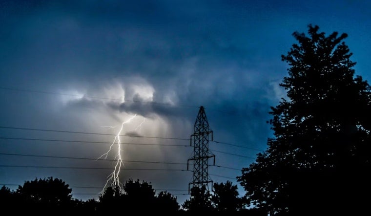
A brutal stretch of 96-degree heat gave way to violent thunderstorms across Metro Detroit last night, snapping power lines and dumping hail as large as 2 inches on communities north of the city. By the time the worst of it passed, utility monitors counted more than 54,000 DTE Energy customers in the dark statewide, with Oakland and Livingston counties absorbing the heaviest hits.
PowerOutage.us tallied 54,614 DTE customers without power across Michigan on Wednesday, with Oakland County logging the state's highest county total at 19,528 outages and Livingston County reporting 15,320 outages — nearly 17% of its tracked accounts. DTE Energy itself reported 22,032 outages as storms tore through the region, according to The Detroit News. The utility serves roughly 2.3 million electric customers across Southeast Michigan, a footprint that made Wednesday's storm line a significant test of grid resilience just as air conditioners were running hardest against the afternoon heat.
The storms followed a scorching afternoon that pushed temperatures to 96 degrees at 2:41 p.m., with the heat index climbing to 103°F as dew points sat between 70°F and 73°F, according to National Weather Service surface observations at Detroit Metropolitan Wayne County Airport. That's a stark departure from Detroit's normal early-September high of 79°F, and it fell well short of the city's September 2 record of 100 degrees, set in 1953. The Detroit News reported storms first struck areas north of Metro Detroit on Wednesday evening before pushing south.
Hail and Wind Gusts Tear Through Suburban Communities
The atmospheric setup behind the outbreak was extreme by any measure. National Weather Service forecasters said surface-based Convective Available Potential Energy surpassed 4,000 J/kg over Southeast Michigan, combining with 0-6 km bulk shear above 40 knots — enough instability and spin to organize storm cells capable of 70 mph wind gusts and 1.5-inch hail. Howell reported gusts of 70 mph, while Birch Run and Capac saw hail up to 2 inches, and Kimball measured 1.5-inch hail, per the same Detroit News account. Williamston and Otter Lake reported 1-inch hail, Parkdale clocked 43 mph gusts, and Ludington saw 40 mph gusts, while Palms, Richmondville and South Park all reported wind damage.
Severe Thunderstorm Warnings were issued for Oakland, Livingston and Macomb counties last night, with the National Weather Service flagging severe storms at 10:25 p.m. Storms tracked along a line from near Oak Grove to near Fowlerville to nine miles southeast of Williamston, moving east at 30 mph. Forecasters warned residents in the path to move to a basement or interior room on the lowest floor of a sturdy building as the cells approached, the article notes.
Warnings Stretch South Into Wayne and Washtenaw Counties
As the line pushed south overnight, the National Weather Service extended Severe Thunderstorm Warnings through midnight into Thursday for Washtenaw and Wayne counties, with storm clusters tracked moving southeast at 30 mph, producing 60 mph wind gusts and quarter-sized hail across Livonia, Canton, Dearborn, Romulus and Taylor, according to Sun Times News. Thunderstorms were expected near Novi and South Lyon around 11:05 p.m., Pontiac around 11:15 p.m., West Bloomfield around 11:10 p.m., Southfield and Birmingham around 11:20 p.m., and Troy, Royal Oak and Northville around 11:25 p.m., per the Detroit News timeline. Warnings for Oakland, Livingston and southern Macomb counties remained active until 11:45 p.m., while Macomb County communities including Center Line, Roseville, Shelby Township, Utica, Fraser and Eastpointe were also in the storms' path.
Flooding concerns lingered well past the wind and hail threat. A Flood Warning covered southwest Macomb County, southern Oakland County and northern Wayne County, remaining in effect until 5:30 a.m. Thursday, with up to 2 inches of rain expected in the heaviest cells. The Dearborn Police Department issued its own flood warning for rivers, creeks, streams and low-lying areas as runoff rose.
Older Sewer Systems Face Renewed Strain
The City of Detroit had issued an extreme heat safety alert early yesterday and urged residents to avoid heavy indoor appliance water use during downpours while keeping basement drains clear, aiming to prevent runoff from surcharging the city's combined sewer lines. Regional stormwater assessments have long shown that basement flooding in Metro Detroit stems mainly from heavy rainfall overwhelming aging combined sewer systems rather than river overflows — a vulnerability documented in June 2021, when more than 5 inches of rain triggered over 24,000 damage claims to the Detroit Water and Sewerage Department, according to Planet Detroit's reporting on the risk. Older inner-ring suburbs in Oakland and Wayne counties remain particularly exposed to sewer backups during short, intense downpours like Wednesday's.
Wednesday's blackouts also arrive against a rougher backdrop for DTE's grid reliability this year. A July 3 storm system knocked out power to more than 380,000 customers statewide and required repair crews from a dozen states and Canada to restore service, according to the Michigan Chronicle, a stretch of outages that drew scrutiny from state lawmakers and the Michigan Attorney General. Under Michigan Public Service Commission rules updated in September 2025, customers are entitled to an automatic daily bill credit of $42 if power isn't restored within 96 hours during catastrophic conditions, or within 16 hours under non-catastrophic conditions. It remains unclear how quickly DTE will restore the more than 54,000 accounts still affected by Wednesday's storms, or whether Oakland and Livingston County customers will qualify for those credits depending on how the outage is classified.





