

























































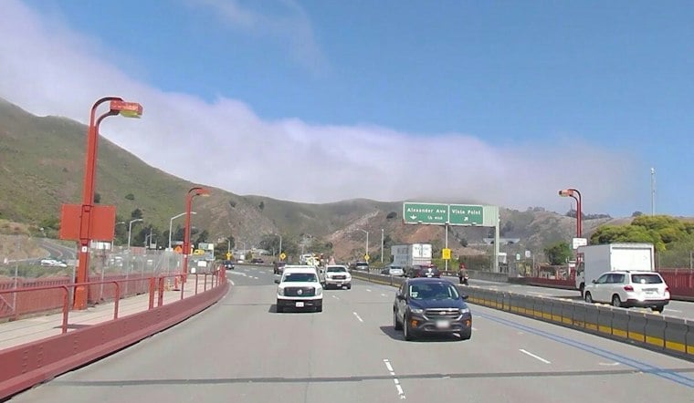
A newly paved bike path beneath the northern end of the Golden Gate Bridge is set to give cyclists heading into Sausalito and the North Bay a route that skips one of Marin County's most notorious stretches of road. The roughly 1,600-foot Vista Point Trail runs near the bridge's North Vista Point and is designed to steer riders away from Alexander Avenue, a corridor cyclists have long used to reach Sausalito from the bridge but which carries a steep freeway off-ramp where cars move fast.
As reported by CBS News, Alexander Avenue recorded 83 injuries between 2011 and 2020, and Tarrell Kullaway said many injuries on the road go unreported, with unreported injuries estimated at about 10 times the number officially logged. The outlet's reporting describes Alexander Avenue as the most dangerous mile in Marin. Jason Isep said his customers are happy crossing the Golden Gate Bridge, and he added that the new trail will reduce cyclists' exposure to nearby, fast-moving cars; his shop, Marina Bike Shop, serves mostly tourists exploring the beauty of the bay, per the same account.
A Road Closed Since 1999 Gets New Life
The path itself is not new pavement over untouched ground — it revives a route that was a preferred cycling route before it closed in 1999.
The Transportation Authority of Marin notes that the 0.3-mile trail connects Dana Bowers Vista Point at the bridge's northern terminus directly to lower Conzelman Road and Fort Baker.
Per the CBS News report, cyclists were expected to start using the trail in less than two weeks from its September 21 publication date, with the ribbon-cutting ceremony scheduled for September 30. Kullaway described the trail's view as gorgeous.
A Group Ride and a Bigger Vision for Marin Cycling
Locals looking to join the celebration have an organized option. The AllEvents listing schedules a group ride at Inspiration Point from 2:00 p.m. to 4:00 p.m. on September 30.
Kullaway said Marin County aims to become the best place for biking in America, and the Marin County Bicycle Coalition maintains a vision network spanning from the Golden Gate Bridge to Sonoma and east to west, believing roads should be prioritized based on safety, according to the CBS News report. The bridge carries pedestrian and bicycle traffic, the coalition's 2025 annual report notes.
Not Every Bike Push in the Region Is Moving Forward
The investment in Vista Point Trail stands in contrast to friction elsewhere in the North Bay. According to the Marin County Bicycle Coalition's 2025 annual report, the coalition helped secure $600,000 for bike lanes along Bridgeway, but the Sausalito City Council rejected the plan.
The bridge carries bicycle traffic, and ferry service links San Francisco and Sausalito.
The new trail also arrives amid a broader debate over cycling access across Marin's open spaces. Bicycles currently have legal access to only 27% of the county's singletrack trails as of 2026, according to Aviva Kamler of Marin Trail Stewards, even as countywide reviews continue over expanding bike and e-bike access. Marin, considered the historic birthplace of mountain biking, still maintains strict restrictions on off-road bicycle access, per Kamler's account.





