

























































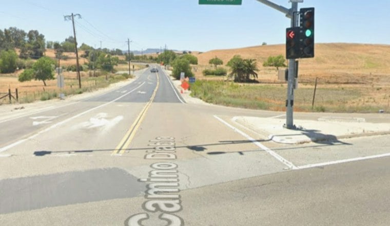
A traffic collision involving an overturned vehicle blocked all lanes of southbound Vasco Road south of Camino Diablo in Brentwood on Tuesday afternoon, snarling traffic at one of Contra Costa County's most crash-prone intersections. The collision also caused injuries.
The California Highway Patrol traffic alert service 511 SF Bay issued an alert about the crash, and Caltrans District 4
retweeted the update as the incident remained ongoing Tuesday afternoon. The alert described an “ongoing” traffic collision with injuries and an overturned vehicle on southbound Vasco Road south of Camino Diablo, with all lanes blocked.
A Junction With a Grim History
The stretch of Vasco Road near Camino Diablo has drawn scrutiny from county officials for years. A five-year county collision study covering 2019 through 2023, compiled from California's Statewide Integrated Traffic Records System, identified the intersection of Vasco Road and Camino Diablo as a primary safety hotspot, recording more than eight severe injury crashes and four fatal crashes on its approaches, according to Contra Costa News. Countywide, the same study tallied 211 vehicle crashes along Vasco Road between Marsh Creek Road and the southern Alameda County line during that five-year span, though the report noted no pedestrian or bicycle collisions were recorded on that stretch during the period.
This is not the first serious incident at the same junction in recent months. On February 25, 2026, an adult male driver died after losing control of his vehicle while traveling northbound on Vasco Road and crashing into a light pole at the Camino Diablo intersection, an incident the California Highway Patrol investigated as a solo-vehicle fatality, the outlet's report noted. Weeks before that, on January 26, 2026, a two-vehicle crash on Camino Diablo near Vasco Road left one victim in critical condition and led to a suspect carjacking a Good Samaritan who had stopped to help. A pursuit involving Livermore ended near Ygnacio Valley Road, where the suspect was believed to have been taken into custody.
Heavy Commuter Traffic on a Narrow Rural Road
Vasco Road functions as a principal rural arterial carrying approximately 22,000 vehicles per day, serving as the main commuter artery linking eastern Contra Costa County with Alameda County and the Tri-Valley region, according to Contra Costa County Public Works. The predominantly two-lane rural corridor is heavily traveled.
Rollovers tied to passing maneuvers are not new to the road either. A January 2024 Vasco Road crash involved six patients, including two with major injuries, and prompted a medical helicopter response. The crash blocked lanes that later reopened. Seasonal weather has compounded the danger too — in December 2025, persistent dense tule fog triggered multiple crashes that closed Vasco Road between Brentwood and Livermore in both directions, and a Contra Costa County Fire Protection District captain was struck and injured while managing one of those crash scenes, according to CBS News.
Safety Upgrades in the Works, But Not Yet Complete
Tuesday's crash landed on the same day that public comments closed on Contra Costa County's newly finalized Vasco Road Corridor Safety Improvement Study Report, which evaluated safety, traffic, infrastructure, and environmental concerns along the corridor between Highway 4 and the Alameda County line. The timing underscores ongoing community demands for safety interventions along the route, the county's report indicates.
Separately, the State Route 4 Bypass Authority advertised the Vasco Road Safety Improvements Phase 2 Project in August, with plans to award a contract in October to build approximately 1.5 miles of concrete median barrier, widen 6,900 feet of roadway, and construct wildlife crossing systems, according to the county's project documentation. That phase targets a winding section of the corridor approximately four miles north of the Alameda County line. It follows Phase 1, completed in January 2012, which installed about one mile of concrete median barrier to prevent cross-median head-on collisions in the corridor's southern segment, funded through Measure J local sales tax dollars and federal ARRA grants, per the Contra Costa Transportation Authority. The project documentation describes partial funding and project limits for the phases.





