

























































A federal appeals court has upheld the Army Corps of Engineers' permit for the sprawling Cainhoy peninsula development in Berkeley County, clearing the way for continued construction on a project that has drawn years of pushback from environmental advocates and nearby residents. The Fourth Circuit's ruling, issued Oct. 23, ends a lengthy legal battle over wetlands, flooding and the future of one of the Charleston area's largest planned communities.
The appeals court unanimously affirmed a lower court decision upholding the Corps' Section 404 permit, finding that the Corps conducted a thorough and reasoned analysis and did not act arbitrarily or capriciously in choosing the least environmentally damaging practicable alternative, according to the published opinion. The court noted that the Corps' environmental assessment reviewed the proposed plan, 14 alternative plans and a no-action option before settling on the current design. As Live 5 News reports, the ruling clears continued development on the peninsula after the litigation produced nine separate motions, orders and opinions, each decided in favor of the permit, according to Point Hope Partners.
Cainhoy comprises 9,076 acres of private land, per the court's opinion, though other accounts describe the footprint as roughly 9,000 or 9,100 acres. The Point Hope development plan itself has been described as allowing for at least 12,000 new homes in one account, while the project's own promotional materials describe a smaller total; the dossier does not resolve which figure is current. The court's opinion states the development will affect 3,906 acres and 181.5 acres of wetlands, with the rest placed under conservation easements or restrictive covenants.
How the Wetlands Number Shrank
The court credited the Corps and the developers with cutting the project's wetlands impact by nearly 90 percent over the life of the planning process, according to Live 5 News. An early design would have impacted 1,820.1 acres of wetlands; that figure dropped to 187.9 acres and then to 181.5 acres by 2022, the court's opinion states. Torrey Sanders, conservation program manager for the Coastal Conservation League, said the site will still see 182 acres of wetland fill, which he and other environmental advocates call the largest modern fill in the Charleston area, per Live 5 News.
Brian Keels, president of Point Hope Partners, said the ruling validated the permitting process. “The Army Corps conducted a thorough review,” Keels said, according to Live 5 News, adding that the company plans to continue work on what he described as a thoughtfully planned community at Point Hope.
Traffic and Flooding Concerns Persist
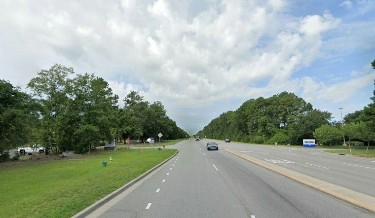
Sanders said traffic on Clements Ferry Road has become severely congested, a complaint echoed by residents who have described gridlock preventing ambulances from getting through near the corridor, according to The Daniel Island News. The road averaged 14,000 vehicles per day in 2015 and is projected to exceed 58,000 vehicles per day by 2040, according to the Post and Courier. Leaders have also projected the population along the corridor could grow to about 80,000 people within a decade, per ABC News 4's coverage of a community forum on the issue.
Environmental advocates worry the development will worsen flooding and damage wildlife habitat, including habitat for endangered species, according to Live 5 News. Sanders pointed to rising sea levels since the original agreement was struck. Environmental groups argue circumstances have changed since that 1992 agreement, and Chris DeScherer, South Carolina office director for the Southern Environmental Law Center, said state law allows the city to revisit the development agreement and make it more protective if conditions on the ground have shifted, per the same report.
A Petition and a Pending State Review
Advocates are circulating a petition urging Charleston residents to push developers back to the negotiating table and reshape the plan. ABC News 4 reported the Coastal Conservation League's petition had gathered more than 5,000 signatures and was slated for presentation to Charleston City Council earlier this year. Sanders has urged residents to pressure elected officials to use whatever legally available tools exist to find a solution that works for everyone, according to Live 5 News.
Separately, South Carolina is reviewing a coastal zone consistency certification covering part of the development, a review that could lead to a public hearing later this year, Live 5 News reported. The state's coastal management program says such reviews are triggered when an applicant submits one or more state permits to alter land, according to the South Carolina Department of Environmental Services. Meanwhile, Charleston is working to rewrite its zoning code to encourage more sensitive development on future projects, which could open the door to low-elevation overlay zones in Cainhoy, per Live 5 News.
The current development plan traces back to 1996, when it was agreed upon by City of Charleston leaders and landowners, according to ABC News 4. Some state leaders maintain more housing is needed to meet growing regional demand, a view that aligns with Charleston County's estimate that the area will need roughly 36,000 additional housing units by 2033, according to Live 5 News's earlier reporting. With the Fourth Circuit's ruling now final, the fight over Cainhoy's future appears likely to shift from the courtroom to city hall and the statehouse, where the petition drive and the pending coastal review remain the clearest avenues left for opponents to seek changes.





